Assessment of Current Ice Conditions Relevant to Distribution and Access of Walrus
Near St. Lawrence Island
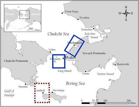
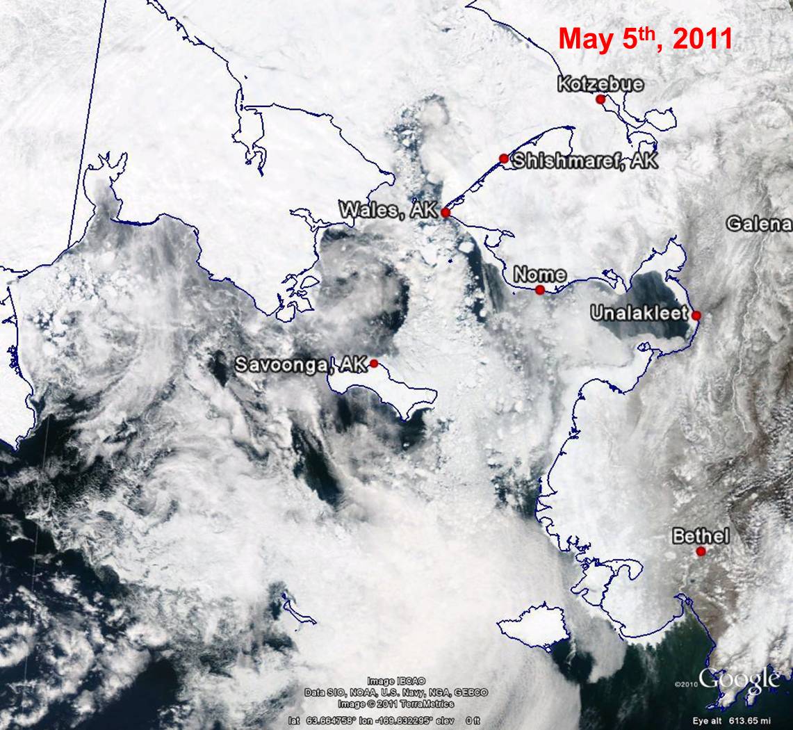
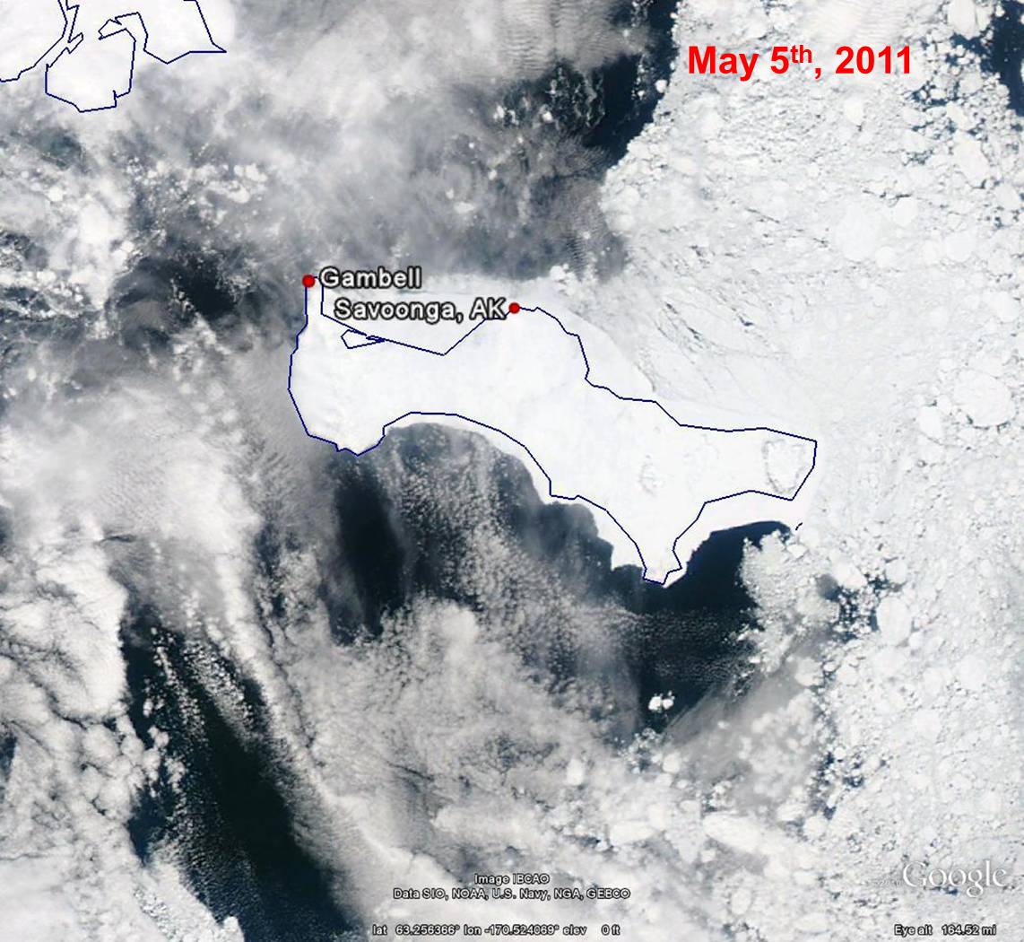
There has been little change in the shorefast ice around Saint Lawrence Island in the last several days. Ice concentrations on the south side of the island have been quite low this week. There has also been an eastward progression of sea ice on the north side of the island. Since ice concentrations have been fairly low to the west side of the island, very little new sea ice has been moving toward the island to replace the ice moving out. Satellite indicates relatively high concentrations of sea ice within 10 miles of the shorefast ice between Gambell and Savoonga, but beyond that ice concentrations are low. East of Savoonga to the northeast side of the island, the ice concentrations are quite high, but this area of higher concentrations is continuing to move eastward.
Wales to Shishmaref
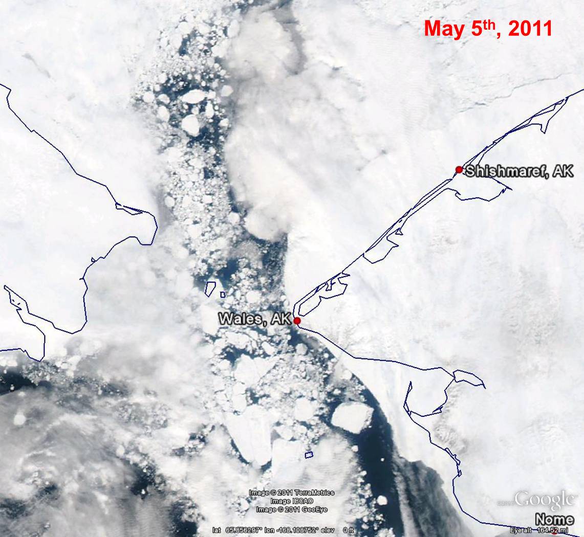
The shorefast ice appears to not have changed much in the last week from Wales to Shishmaref, with extensions ranging from 20 to 25 miles. The shorefast ice around Wales is a mile or less in extent. Ice concentrations north of the shorefast ice remains quite high with open leads. The western side of the shorefast ice was relatively low for almost 10 miles from shore until Thursday, 5 May. Now, an area of higher ice concentrations, which had been moving east the last several days, is located very close to shore.
5 to 10 Day Forecast
Around Saint Lawrence Island, the sea ice will likely continue moving eastward, keeping ice concentrations low around all but the east and northeast sides of the island for the next several days. The high concentrations of ice west and southwest of Wales will likely remain in place.
Early next week, a stronger low pressure system is expected to move into the Bering Sea, bringing stronger southerly winds to the entire region. The system is expected to remain nearly stationary for much of next week and weaken over time. As a result, an extended period of southerly winds is expected next week. This long duration of southerly winds will likely bring an area of high ice concentrations (currently located 50 miles southeast to 100 miles southwest) closer to Saint Lawrence Island. It is possible that this ice could eventually be located fairly close to the southern coast of Saint Lawrence Island by late next week. The southerly winds will continue through the Bering Strait through much of next week and will keep ice floes moving north in high concentrations. The southerly offshore winds between Wales and Shismaref will likely result in northerly movement of the sea ice which would open up the waters just north of the shorefast ice from the middle to latter part of next week.
Arrows show wind direction and wind speed in knots


Remote Sensing Images


Observations and Comments
Observations of Sea Ice Development
6 May 2011 - Paul Apangalook; local observer in Gambell
April 2011 Sea Ice Summary from Sivuqaq/Gambell
The ice in the area remained thin and sparse mixed with larger thicker ice, and open water becoming more prevalent as the month of April progressed. The visible area became ice free for several days on 21 April; the kelleghinak [large polynya between St. Lawrence Island and Siberia] was first spotted from on shore on that day, although boat crews had been reporting open water to the northwest early on. New ice had begun to form, but was easily broken up by higher winds and rough seas.
The ice pack we had in the first two weeks of April may have drifted out of the area by mid-April and was then replaced with thicker and more stable ice from the southwest as the north current increased and flowed continuously. By 27 April, that ice pack drifted out, but remained visible at the horizon to the northwest of Gambell. Signs of it were also visible to the southwest. Open water everywhere; the ice edge was visible from northwest, eastward at about seven miles. By 30 April, conditions remained the same, with compact ice to the north and northeast and scattered loose ice to the west.
Walrus hauled out on ice were spotted daily, but smaller in concentrations and scattered. Hunters who were able to go out by boat were successful. The catches were mostly male walrus. There were plenty of game, including some spotted seals and lots of maklak. Both villages were able to get whales, about three larger whales and two small young ones, three in Gambell and two by Savoonga crews at Pugughilek (Southwest Cape).
28 April 2011 - G. Carleton Ray; research professor at the University of Virginia
Walrus/ice association perspective, based on February 2011-to-current images and a weather conditions summary from Gary Hufford at NWS.
[The material from Gary] gives me enough to generate some rough, uncertain guesses. Conditions on 2/10 give no indication that walruses could not have reached their "traditional" winter breeding habitats: outer Bristol Bay to Nunivak and west-central Bering Sea. By 2/21, these habitats are literally destroyed, probably by the warm conditions Gary describes. Where the walruses might have gone is anyone's guess, perhaps they remained on isolated floes, and there are hints of that in the image, but I would not eliminate haulouts on land. By 2/26, the situation seems even worse. The Gulf of Anadyr seems almost devoid of ice, but for the usually very cold area within Kresta Bay and some shorefast ice. On 3/6, we see some encouraging signs, namely wide distributions of the angular floes typical of "broken pack." What is not evident are the distinctive seascapes described in our GRL paper last fall, indicating the "mixing bowl effect" -- a term I coined for conditions of sparse sea ice and wind-mixing of floes, resulting in habitat confusion. By 3/29, there appears to be some recovery of these seascapes, notably rounded pack to the east, albeit with a very wide easterly zone that appears to be ice-free and which could provide a route for the SE walrus group to head north; there also appears to be good walrus habitat between St Lawrence and the Chukchi Peninsula. The 4/5 image indicates continued reformation of seascape although the cover and extent indicate the early signs of April breakup, which leads me to ask; breakup of exactly what? On 4/10, we see the effects of the "big storm" mentioned by Gary. Some shorefast ice seems to remain, but the best ice for walruses seems again to be between St. Lawrence and Chukchi. By 4/10, this ice seems to be in full retreat, but on 4/15, seems to have been pushed south again -- no surprise for the season of retreat when wind shifts can move ice 100+ miles a day, or more. There's also some remnant ice ("last ice") in the Gulf of Anadyr, which will probably move more or less directly east. Watch for ribbon seals!
What I conclude for this is big trouble for walruses. Breakup of habitat, through either diminishment of ice per se and/or the mixing bowl effect, has especially serious impcations for highly gregarious species, such as walruses, that require lots of room for "normal" reproductive and other activities (see Ray et al 2006). Production as well as survival are at stake.
What would really help with interpretation would be some village observations. I would think that walruses, as well and bowheads, would have remained in the vicinity of Gambell, off and on, from March until now. This is well north of the situation of the 1980s through the 1990s. Also, look for ribbon seals coming from Anadyr any day now.
