Assessment of Current Ice Conditions Relevant to Distribution and Access of Walrus
Near St. Lawrence Island
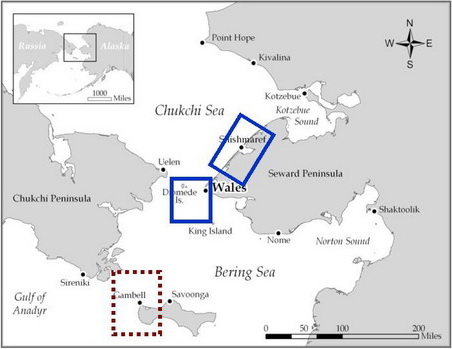
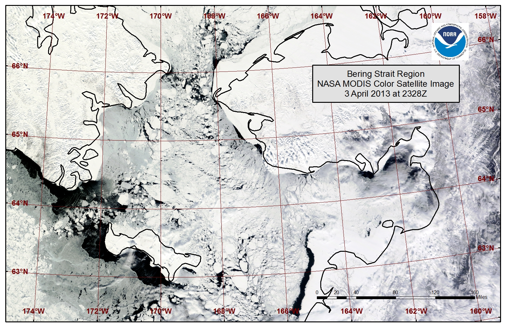
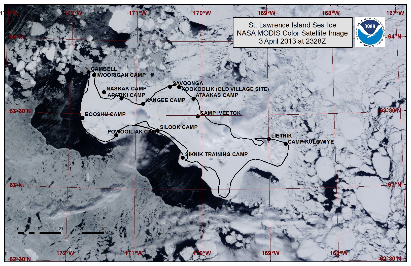
The bay between Gambell and Savoonga has been compacted with first year thin to first year thick ice that has likely grounded in several locations. From Savoonga over to the eastern side of the island lies very close pack ice consisting of first year thin to first year thick ice. Beyond the shorefast ice from Gambell down the western side of the island lies a polyna (an area of open water surrounded by sea ice) up to 21 miles wide. Close pack ice lies beyond the polyna with new and young ice filling in between the floes. A polyna is also present beyond the shorefast ice along the southern shoreline of St. Lawrence Island up to 20 miles wide. Due to temperatures remaining well below freezing, both polynas will likely have new and young ice forming rapidly within them.
Wales to Shishmaref
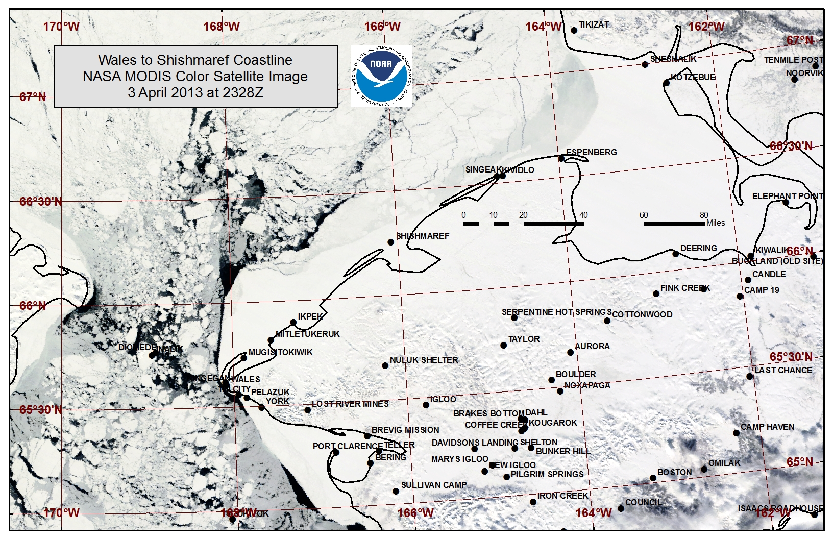
Northeasterly flow along the coastline has created areas of small polynas and leads beyond the shorefast ice from Mitletukeruk to Shishmaref. There is still slow export of close pack ice through the Bering Strait. The extent of the shorefast ice currently varies from roughly 11 miles off Mugisitokiwik to 20 miles off Ikpek to 5 miles off Shishmaref. Beyond the shorefast ice near Shishmaref up to Kotzebue Sound lies an area of very close pack ice consisting of young to first year thick ice that is beginning to destabilize with the northeasterly flow aiding in opening leads within the offshore ice pack.
5 to 10 Day Forecast
A pattern sets up over the next week for colder air to filter into the Bering Sea and Chukchi Sea and remain through the week. Weather systems will remain in the North Pacific and Gulf of Alaska and keep the flow generally out of the north. Northeast winds of 20 to 30 mph (15 to 25 knots) will be prevalent Friday (5 April) through Sunday (7 April) before becoming lighter North to Northwest at 5 to 25 mph (5 to 20 knots) during the mid-week (9-11 April) timeframe. Leads may continue to open beyond the shorefast ice from Wales to Shishmaref through Sunday (7 April). As flow turns more onshore mid-week (9-11 April), open leads will freeze over and offshore ice floes will close in along the shorefast ice edge. Expect the polynas along the western and southern coastlines of St. Lawrence Island to remain open with low concentrations of new ice through Sunday (7 April). The polyna areas will likely rapidly freeze over with new and young ice forming Tuesday through Thursday (9-11 April) as wind speeds decrease.
The weather pattern will be changing late in the week with south winds of 10 to 20 mph (5 to 15 knots) starting Friday (12 April). Over next weekend (13-15 April) southerly winds increase to 20 to 35 mph (15 to 30 knots). Expect polynas along the southern and western coastlines of St. Lawrence Island to close in with high concentrations of young to first year medium ice Friday (12 April) through Monday (15 April). Sea ice compacted within the bay from Gambell over to Savoonga may be shifted back to the north out of the bay depending on how well grounded the ice is from previous weeks' northerly winds. Expect a polyna to form beyond the shorefast ice of the northern coastline of St. Lawrence Island Friday (12 April) through Monday (15 April). The southerly flow is expected to compact the ice floes near the Bering Strait, and the very close pack ice beyond the shorefast ice from Wales to Shismaref may be destabilized with numerous leads or a polyna forming. The very outer edges of the shorefast ice may also begin to break off during this period of southerly flow.
Arrows show wind direction and wind speed in knots


Remote Sensing Images
Observations and Comments
Observations of Sea Ice Development
Comments from Gambell
9 April 2013 - Paul Siluk Apangalook
Most of the ice in the area near Gambell is little more than a foot thick, quite thin for this time of year. There is a lot of open water along the Siberian coast and it may be accessible under ideal weather and ice conditions. The thickest ice is currently found north and northeast of the village, with multilayered, pressured ice piled up against the coast.
Boats have been out to hunt whale and walrus. However, access to the ocean and back to shore has been hindered by new ice that is forming rapidly in low temperatures. Later in the spring, thicker ice is expected to arrive from the south, bringing walrus with it.
Comments from Shishmaref
6 April 2013 - Ken Stenek, Shishmaref School
Report of the ice breaking up between the Diomede Islands. Little Diomede's "runway is floating away to Russia."
Comments from Wales
5 April 2013 - Winton Weyapuk, Jr.
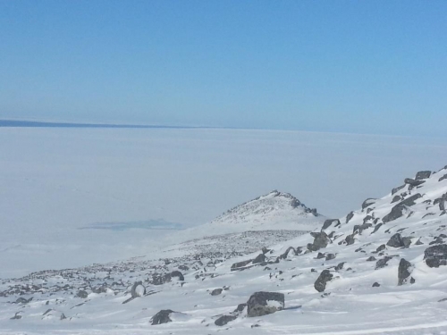
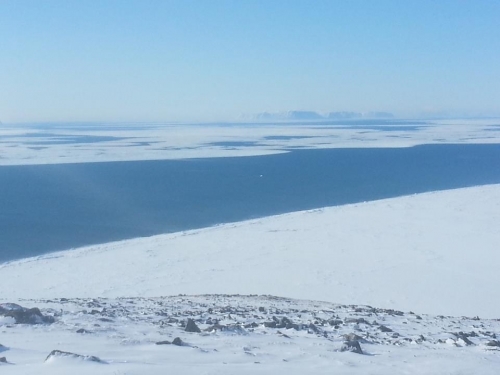
This past week we have had mainly northeasterly winds varying in intensity which has opened and closed the lead whenever the wind calmed down. The current has been flowing from the south which is not unusual but in years before, the southerly current would not begin in earnest until late April or early May. Pack ice has consisted mainly of new ice up to four inches thick with small ridging in the pack. We have not seen heavier ice lately as there has not been any movement of pack ice from the north to the south.
4 April 2013 - Amos Oxereok
Yesterday's lead opened up pretty far around the bend up North.
Comments from Savoonga
5 April 2013 - George Noongwook
With high winds up to 35 mph (30 knots), people are waiting out the weather before setting out for the hunt on the south side of the [St. Lawrence] island, most likely next week. For the past week it has been windy and also very cold. As a result, too much young ice is coming in at the hunting sites on the south side of the island which prevent boats from going out as well. Typically, whales are harvested beginning around 11 April and continuing for a couple of weeks.
Winds out of the Northeast have also closed up the ice in front of Savoonga. The ice near town is rough, as a result of high winds pushing the ice toward the shore. People have been going out fishing for crab.
28 March 2013 - Vera Metcalf, Eskimo Walrus Commission
These are great maps for whaling captains, at least in Savoonga, where they can concentrate their hunts and increase the likelihood for a successful hunt. Savoonga crews have to travel to the south side of St. Lawrence Island so these types of maps are also useful because they show whether to travel back as more open water is sighted.
Comments from Nome
22 March 2013 - Fred Tocktoo, NPS
This year (2012-13) ice appeared relatively late, as more common in recent years, with shorefast ice forming in late December. By January shorefast ice was in place for distances up to at least a mile and a half from shores south of Nome. Ice is moving around beyond two miles out from the shoreline. The rivers froze in late October or early November this year. Snow came much later in late December. Presently, our shorefast ice is set up and in place but ice movement is active just beyond the edge of the shorefast ice.
