Assessment of Current Ice Conditions Relevant to Distribution and Access of Walrus
Near St. Lawrence Island
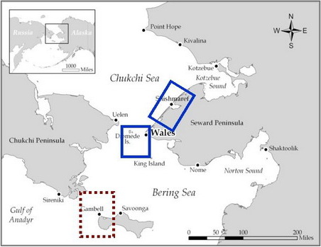
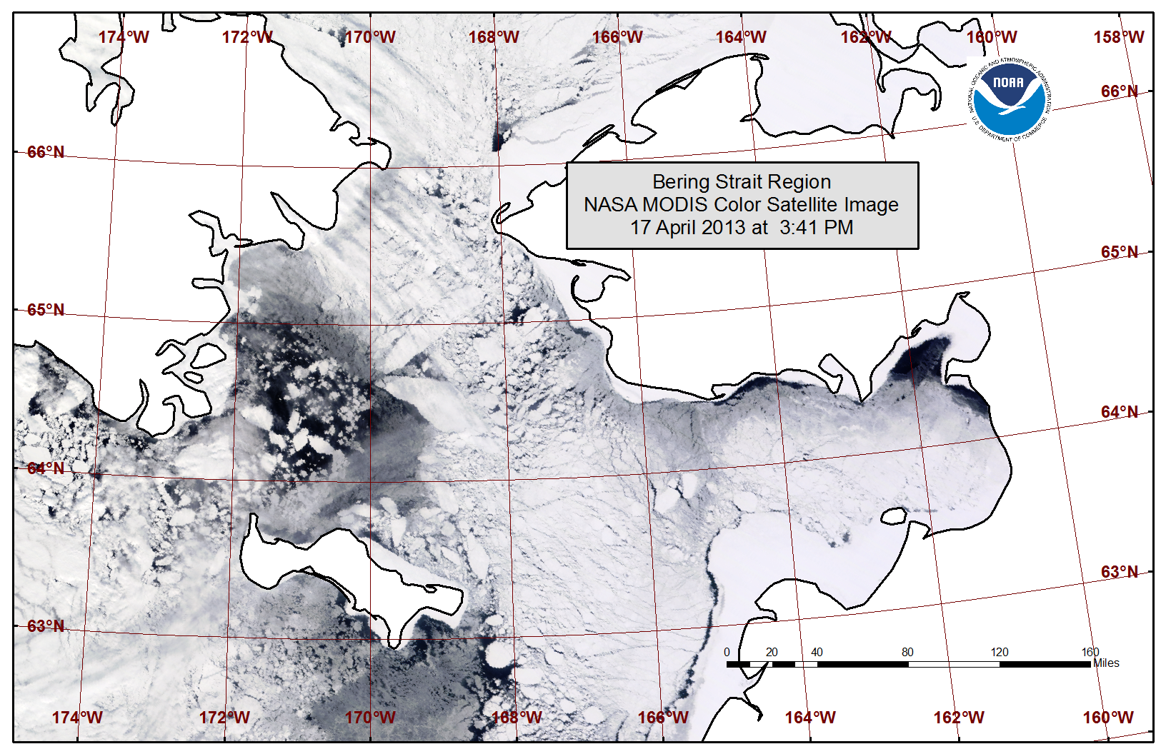
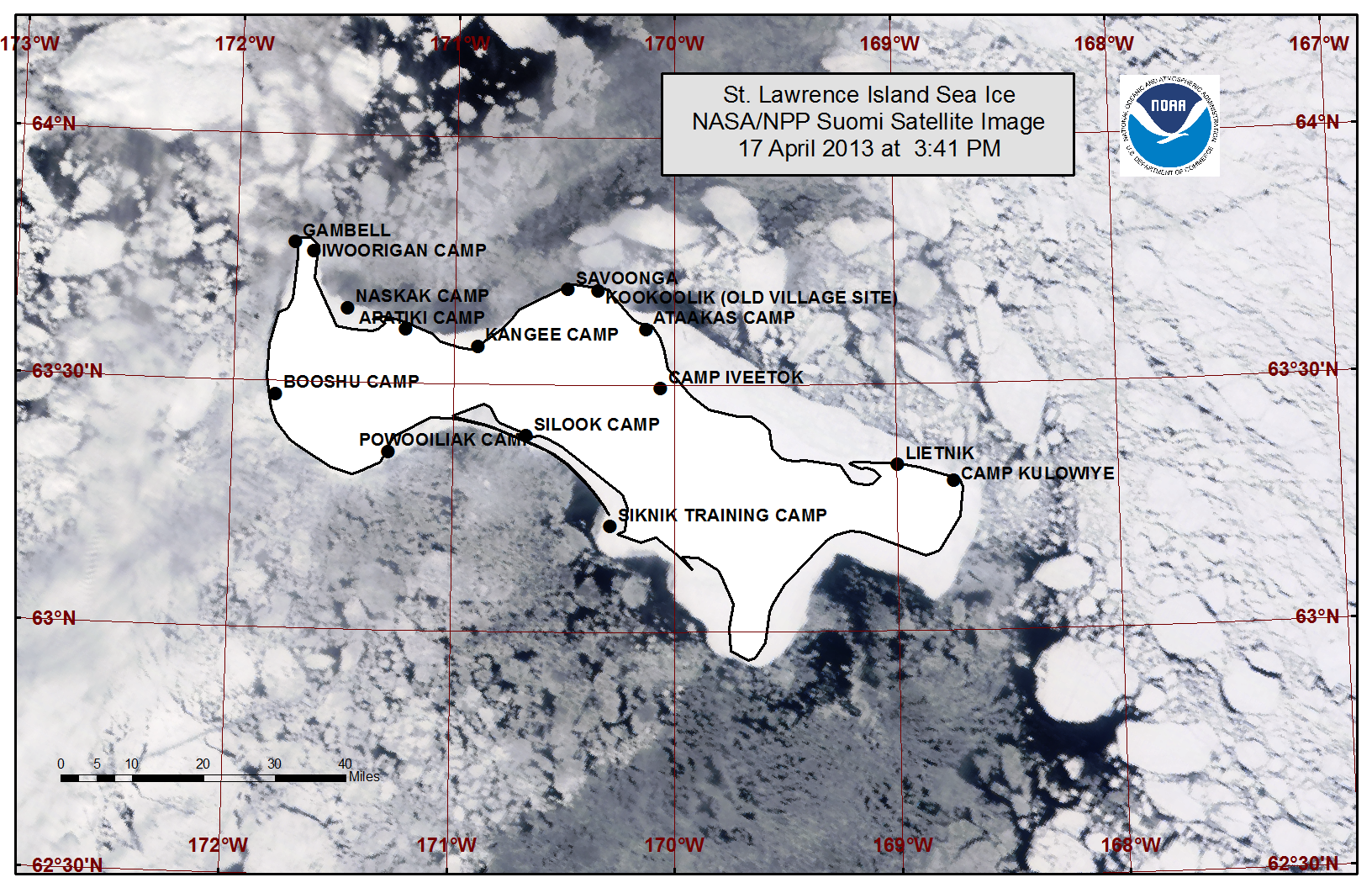
Shorefast ice between Gambell and Savoonga has broken off and can be seen on satellite images, in the ice pack north of Saint Lawrence Island. Stable shorefast ice along the northeast coast is limited to within 5 miles from the shoreline. The shorefast ice extending beyond this appears to thinning with breaks clearly visible along the outer edge. The remaining shorefast ice around the island extends 2 to 5 miles in most locations and appears stable along east and west facing coasts. Free-floating ice is most concentrated to the east of the island. Lower concentrations with small areas of open water are present near both Gambell and Savoonga.
Wales to Shishmaref
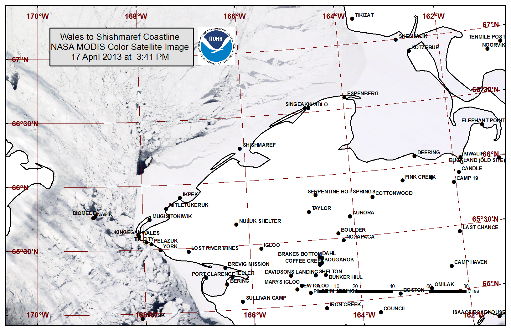
Shorefast ice along the northwest Seward Peninsula is following a near normal pattern, extending 25 to 35 miles off the coast near the point angling to only about 5 miles beyond the barrier islands near Shishmaref. Large breaks can be seen in ice beyond this distance. Sea ice appears to be moving normally through the Bering Strait with floes becoming smaller as they approach the area.
5 to 10 Day Forecast
Air temperatures are expected to remain slightly below normal through the next ten days. Generally, high pressure will remain over the area with light and variable winds. Sea ice will remain fairly constant, but due to the angle of the sun it will begin to slowly lose concentration and thickness. An area of low pressure will move through the Northern Chukchi and Beaufort Seas Monday and Tuesday, 22-23 April, producing west winds of 15 to 20 mph (10-15 knots). This will move the ice toward the west coast of Alaska and across St. Lawrence Island about 10 to 20 miles. High pressure returns for Wednesday and Thursday, 24-25 April, with light (<15 mph or <10 knots) and variable winds. A weak low pressure system is anticipated to slide by on Friday the 26th, turning the winds northerly and around 15 mph (10 knots). High pressure behind this low will keep winds light or northerly around 5 to 15 mph (5 to 10 knots) through Monday, 29 April. With light northerly flow expected from Friday the 26th to Monday the 29th, sea ice floes will move to the south about 10 to 20 miles.
Arrows show wind direction and wind speed in knots


Remote Sensing Images


Observations and Comments
Observations of Sea Ice Development
Comments from Wales
21 April 2013 - Winton Weyapuk, Jr.
Hunters have been waiting for the lead to open for the past several days. There is a lot of pack ice on the eastern side of the strait now.
Comments from Nelson Island Region, eastern Bering Sea
21 April 2013 - Hajo Eicken, UAF
Hunters from Nelson Island (Toksook Bay) have reported persistent northerly winds prior to this weekend, keeping the ice pack close in and preventing boats from going out. This weekend, winds shifted and died down, allowing a number of boats to access the main channel of Etolin Strait, southeast of Toksook Bay. While new ice was forming overnight, during the day ice was beginning to melt. A few walrus sightings were reported.
Comments from Shishmaref
18 April 2013 - Greg Deemer and Olivia Lee, UAF
We traveled a few hundred yards from shore, slightly beyond the tidal crack in the shorefast sea-ice on the western edge of town. The thickness of the level ice at this location was 1.30 meters (4 feet, 4 inches) with roughly 10cm (4 inches) of snow on top. The large expanse of shorefast ice here is quite level, with only a few rafted pieces strewn about. After talking with locals, there also seems to be fewer ridges this year than in previous years. Hunting activities have yet to begin in the town, and after speaking with local hunters, there will still be a couple of weeks before hunting crews mobilize to pursue bearded seals.
