Assessment of Current Ice Conditions Relevant to Distribution and Access of Walrus
Near St. Lawrence Island
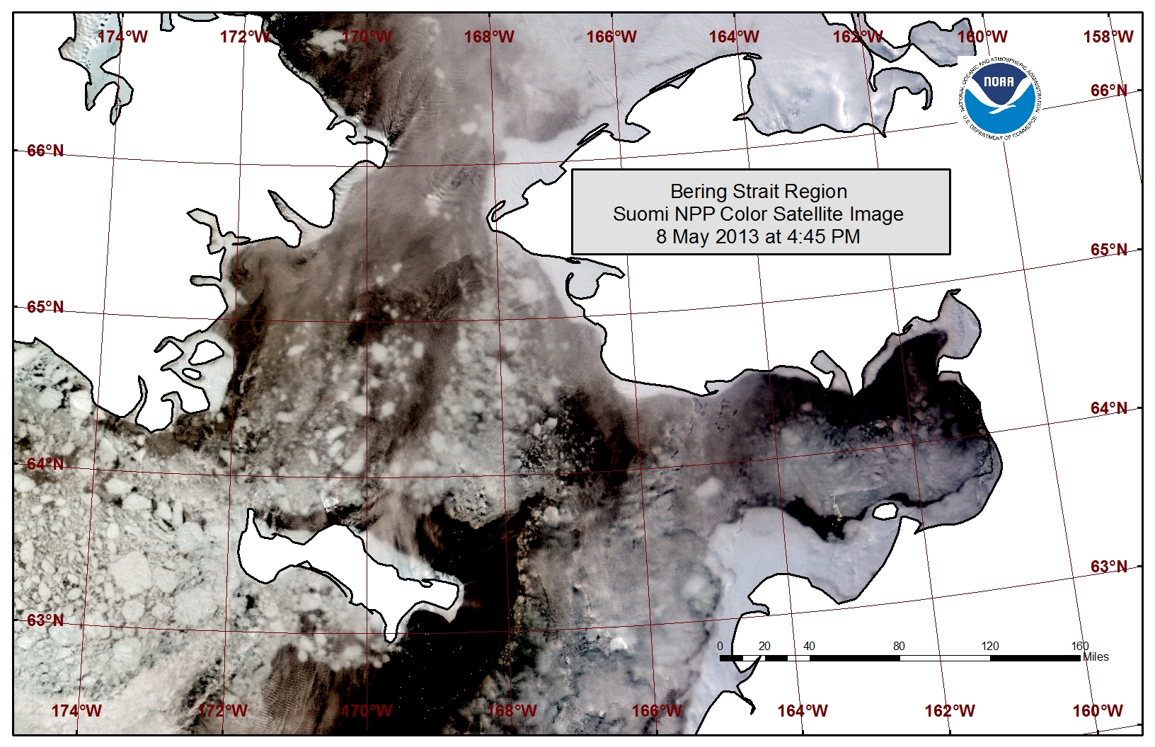
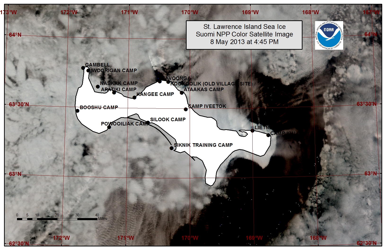
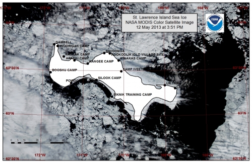
Persistent southwesterly flow near St. Lawrence Island allowed close pack ice to fill in the polyna that was present along the southern coastline of the island last week. The southwesterly flow has also opened a polyna beyond the shorefast ice off the northern coastline stretching from just east of Gambell over to the eastern side of the island as seen in satellite imagery. The polyna is roughly 5 miles wide near Savoonga and up to 25 miles wide near Lietnik along the northeastern coast of the island. Beyond the polyna lies a region of close pack ice.
Wales to Shishmaref
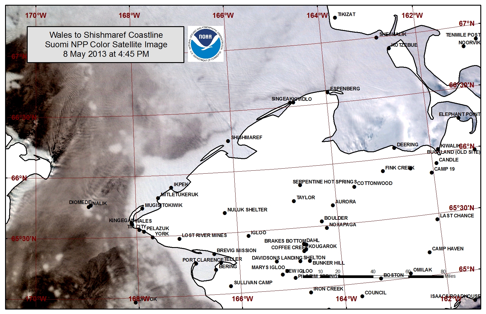
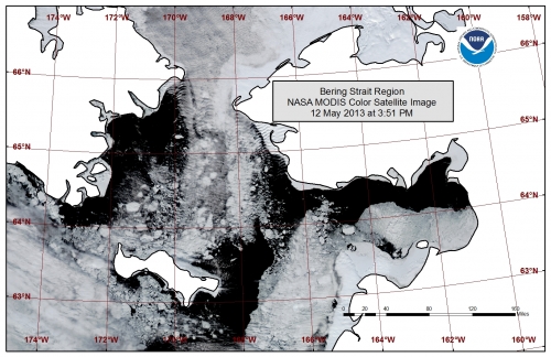
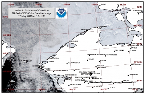
Persistent southerly flow through the Bering Strait has consolidated the main pack ice of the southern Chukchi Sea to a point near Shishmaref. Open to very open pack ice remains near the Bering Strait, and a polyna, roughly 10 miles wide, has formed beyond the shorefast ice edge between Ikpek and Shishmaref. The shorefast ice extent along the coast varies from 5 miles off Shishmaref to 18 miles off Ikpek to 12 miles off Mugisitokiwik. The outer edges of the shorefast ice are becoming unstable.
5 to 10 Day Forecast
A low-pressure system is moving through the Chukchi Sea and into the Beaufort Sea Friday, 10 May, with southwest winds of 10 to 15 mph (5 to 10 knots). The polyna off the northern coastline of St. Lawrence Island is expected to remain open through early this weekend. High pressure will move into the eastern Bering Sea Saturday as another low pressure system moves out of Siberia with the winds remaining in the 10 to 15 mph range. High pressure will build from the Arctic behind the low on Sunday with an increase of winds from the north at 15 to 20 mph (10 to 15 knots). At this time, temperatures will cool to 5 to 10 degrees below normal with daytime highs in the mid 20s to mid 30s. Expect the polyna off the northern coastline of St. Lawrence Island to begin closing in with pack ice over the weekend and a new polyna to begin forming off the southern coastline of the island. The pack ice will also close the polyna off the coastline from Ikpek to Shishmaref. As the winds turn northerly through the Bering Strait region the consolidated pack ice in the southern Chukchi Sea will spread out to the south passing through the Bering Strait into the northern Bering Sea.
There will be times of weaker flow from the north through mid-week, but there is a good chance of stronger northerly flow toward the end of next week. North winds of 15 to 25 mph (10 to 20 knots) are anticipated by Friday, May 17th. This pattern will remain through next weekend. During this time expect pack ice to continue shifting south through the Bering Strait into the northern Bering Sea. The polyna off the southern coastline of St. Lawrence Island will continue to expand during this time.
A low-pressure system will move into the northern Bering Sea Monday, 20 May with winds switching to the south at 15 to 20 mph (10 to 15 knots). As the winds switch to southerly, polynas along southern coastlines will begin to close once again. Overall, the below normal temperatures and moderate northerly flow will continue from this weekend through next weekend, bookended by days of south winds.
Arrows show wind direction and wind speed in knots


Remote Sensing Images
Observations and Comments
Observations of Sea Ice Development
The NOAA/NWS Sea Ice Desk contributed additional satellite imaging with clearer conditions, dated 12 May 2013:
Comments from Shishmaref
10 May 2013 - Ken Stenek
Nothing has really changed since [mid-April]. Top layers of snow are beginning to melt with warmer temperatures. Snow is becoming larger individualized ice crystals. Hunters are digging snow out of their boats so that they can drain and dry. Hearing that hunters are going out in Norton Sound though.
