Assessment of Current Ice Conditions Relevant to Distribution and Access of Walrus
Near St. Lawrence Island
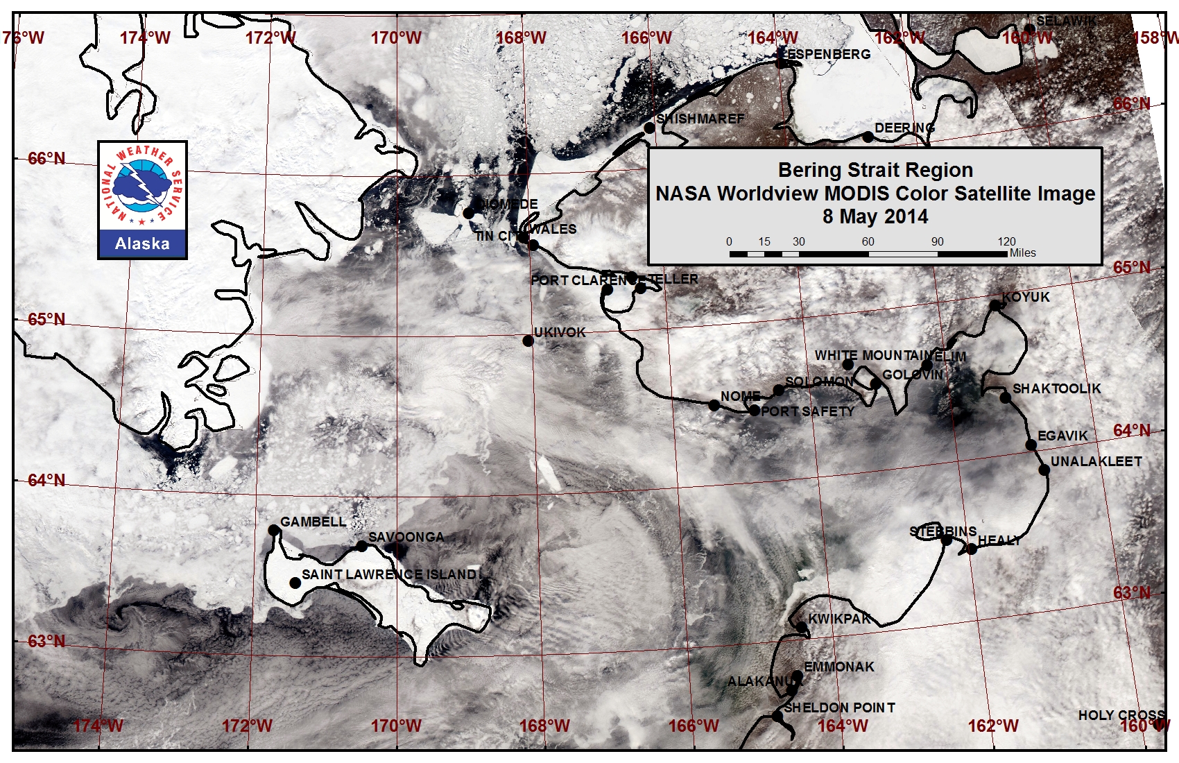
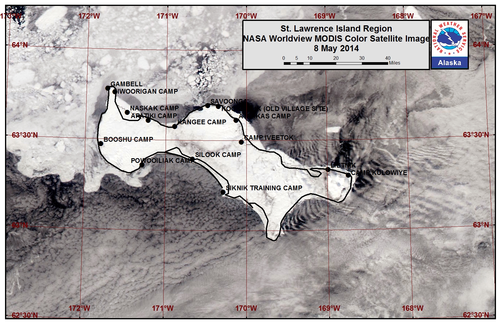
Satellite imagery shows a large polynya along the southern coastline of St. Lawrence Island stretching over 100 miles to the west-southwest. Grease ice covers parts of the polynya, mainly forming overnight and melting during the day. Another polynya lies off the northern coastline from just east of Savoonga over to the east coast of the island stretching 35 to 55 miles beyond the shorefast ice edge. Shorefast ice in this region is beginning to destabilize and break off. Very open pack ice consisting of brash ice to big floes lies off the east coast of the island. Very close pack ice consisting of small to vast ice floes lies off the west coast of the island and the north coast from Gambell over to Savoonga. The shorefast ice along the northern coastline of the island extends roughly 1 to 4 miles, while the shorefast ice along the southern coastline is mainly limited to the lagoons.
Wales to Shishmaref
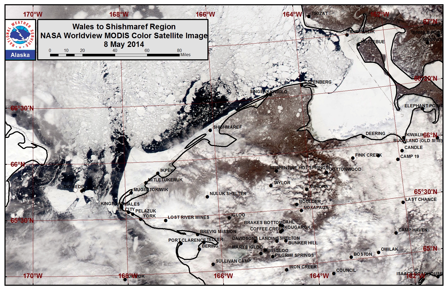
The outer extent of the shorefast ice from Ikpek up to Shishmaref remained relatively stable this past week. The shorefast ice extent along the coast now varies from 2 miles off Shishmaref to 19 miles off Ikpek to 8 miles off Mugisitokiwik. The outer extent of the shorefast ice along this coastline formed later in the year and the outer extent of the shorefast ice from Wales up to Ikpek may destabilize this week. Close to very close pack ice lies in the eastern half of the Bering Strait and consists of small to giant ice floes with areas of leads freezing over with new and young ice. An area of open pack ice stretching 5 to 20 miles wide lies beyond the shorefast ice from Ikpek to near Singeak.
5 to 10 Day Forecast
Weather System/Wind Synopsis
A low-pressure system over the western Bering Sea will move slowly north over the next couple days and weaken over Eastern Russia by Monday, 12 May. Southerly winds will be rather strong Friday, 9 May at 25 to 35 mph (20 to 30 kt), and will weaken to 15 to 20 mph (10 to 15 kt) by Monday. As high pressure remains over mainland Alaska into Tuesday, 13 May, the southerly winds of 15 to 20 mph (10 to 15 kt) will continue. A stronger low moves into the Southern Bering Sea Tuesday evening. Winds will turn to the east on Wednesday at around 15 mph (10 kt). The low will slowly move into the Northwest Bering Sea Thursday as winds pick up from the southeast at 20 to 25 mph (15 to 20 kt). The low will weaken Friday, 16 May in the western Bering Sea and southeast winds will decrease to 15 to 20 mph (10 to 15 kt). Another low moves out of the North Pacific into the western Bering Sea on Saturday, 17 May. This low will remain in the southwest Bering Sea into Monday, 19 May. Winds will remain southeast 15 to 20 mph (10 to 15 kt).
Temperature Trend & Ice Forecast
Temperatures are anticipated to be well above normal along mainland Alaska (10 to 15 degrees above average) with lows in the 30s and highs in the mid 40s to mid 50s. Along St. Lawrence Island, temperatures are expected to remain near normal with lows in the upper 20s and highs in the mid 30s. Due to the very warm temperatures along mainland Alaska, ice melt out will continue for thinner ice and near river deltas. Shorefast ice will likely become more unstable. Due to the predominant southerly flow, ice floes will move north to northwesterly during the week. In addition, we can expect the polynya south of St. Lawrence Island to decrease as areas of ice in the northern Bering Sea push north.
Arrows show wind direction and wind speed in knots


Remote Sensing Images
Observations and Comments
Observations of Sea Ice Development
Observations from Nome
13 May 2014 - Fred Tocktoo
Nome's shorefast ice is all broken up and starting to scatter; ice movement northward through the Bering Straight is on. This weekend saw some wave action coming to the shore of Nome, which means that our Norton Sound ice is on the move and there is not much ice left out there so the window is closing for Nome's spring hunt for sea mammals, which is about a month early.
Observations from Shishmaref
9 May 2014 - Curtis Nayokpuk
Windy (northeasterly) yesterday, and hunters report poor conditions for hunting (no luck). The boat launch had 3-4 ft. waves at its edge on return.
8 May 2014 - Curtis Nayokpuk
Shorefast ice is stable and hunters are launching to hunt Bearded Seals. Shorefast "winter" ice averages 3ft, and the launch site is 3 miles from town.

Observations from Wales
4 May 2014 - Greg Deemer and Josh Jones, UAF
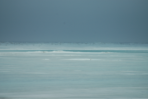
A wintery rain/snow mix along with 40 mph southerly winds persisted on Wednesday and Thursday, 30 April and 1 May, hindering work on the ice. Much of the snow melted completely or turned to slush due to rainfall and temperatures rising into the upper 30s. A few expansive melt ponds have formed on the shorefast ice near town as a result of inland runoff. This year, the grounded pressures ridges in front of the school in Wales are nearly one mile closer to shore. There is extensive, newly formed rubble ice beyond the first line of ridges caused by southerly winds. (see image 1).
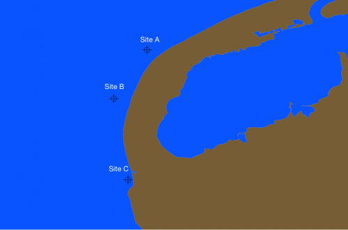
On Friday (2 May) afternoon the southerly winds relaxed, allowing for ice core sampling along the shorefast ice. Three ice cores were taken. A general increase in ice thickness was measured from site A to site C (see image 2). The thinnest ice at site A is 89cm (2ft 11in), site B measured 95cm (3ft 2in), and site C is thickest at 102cm (3ft 4in). Rafted shorefast ice can be found a few hundred feet seaward of site C. The effect of Cape Mountain on surface wind speed was also investigated on the sampling day. At site A, 5 miles north of Cape Mountain, sustained southerly winds were approximately 9mph. The wind speed increased closer to town where locally funneled flow around Cape Mountain produced an average sustained wind speed of 21mph.
Saturday (3 May) brought intermittent bands of precipitation and gusty winds, with a few calm periods of weather throughout the morning and early afternoon hours. Winds began to shift to a southwesterly and westerly direction by the evening hours. Winds weakened throughout the day, allowing pack ice to briefly peel away from the landfast ice edge.
Observations from Gambell
1 May 2014 - Paul Apangalook
The season progressed fairly quickly. The whale hunt didn’t launch on schedule in the beginning of April, but a few boats got out in mid April. Until the last storm, the ice was fairly close to shore. The shorefast ice had large pressure ridges but wind generated swells broke it out. There may still be some ice to the west, but if the winds keep up it will probably move out as well. Before the storm there were signs of large floes, but now we are mostly seeing broken up floes. Gray whales have been seen already, and people are worried about the whaling season being largely over.
30 April 2014 - Kari Rasmussen
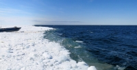
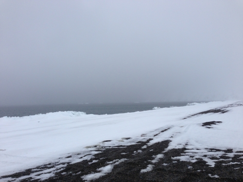
Picture shows open water from the north coast of Gambell after several days of storms and strong winds. (approx location: 63.782 N, 171.718 W).
29 April 2014 - Merle Apassingok
On Friday, 25 April during a trip a little over 10 miles from shore there were plenty of walrus and seals, but still too much ice. The shorefast ice broke from the recent storms, and 29 April was approximately the fourth day of open water. The pressure ridges on the west beach were pretty high this year, and looked higher than in previous years. The winter shorefast ice broke out a couple of months ago, and the ice that recently broke off with the swells had replaced the winter ice in early March.


