Assessment of Current Ice Conditions Relevant to Distribution and Access of Walrus
NEW FOR 2017: Click the name of each community below to view more frequently updated and detailed information from the National Weather Service.
Near St. Lawrence Island
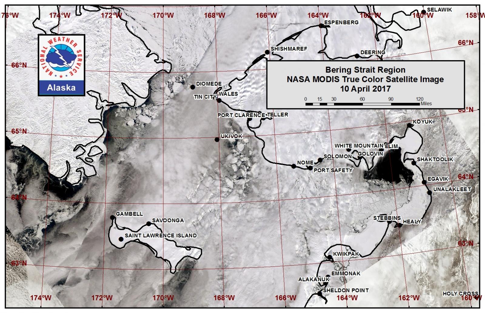
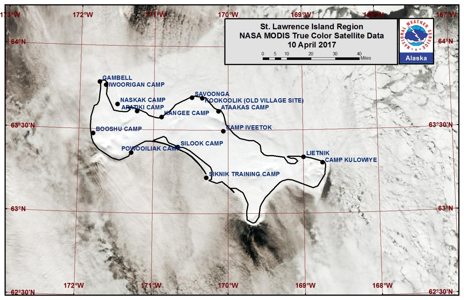
Sea ice is shorefast along the north and east coasts of St. Lawrence Island out 2 to 7 miles from the coast. Shorefast ice on the northwest side of the island has diminished to zero to 2 miles as several big to vast floes have broken off of the shorefast ice. Most of the shorefast ice has diminished on the south side of the island with open water extending up to 65 miles off the coast. A polynya has formed on the northeast side of the island up to 10 miles off the coast. The east side of the island beyond the shorefast ice is open pack ice with medium to big floes. There is open water west and southwest of Gambell.
Nome
Shorefast ice extends up to 6 miles from the Nome area coast, but is generally 1-2 miles. Otherwise there is close to very close pack ice throughout the northern portion of Norton Sound with big to giant floes. The polynya to the west has closed significantly to 1 to 2 miles as close pack ice with vast floes has moved into the area.
Wales to Shishmaref
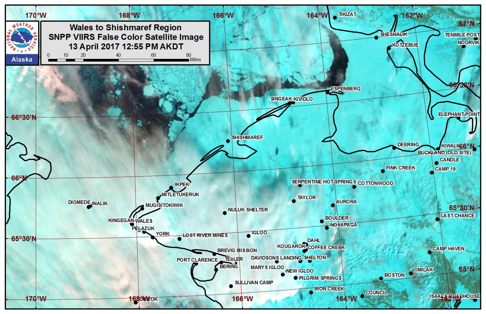
Shorefast ice extends to approximately 10 to 12 miles from the coast between Wales and Shishmaref. Beyond the shorefast ice is very close to consolidated pack ice.
Little Diomede
Close to very close pack ice surrounds Little Diomede Island.
Forecast Discussion
Ice Forecast
Sea ice will continue to loosen through the Bering Strait through April 19th as southeasterly flow will prevail. Near the Wales to Shishmaref coast, sea ice is expected to remain as very close to consolidated pack ice. The polynya off the Wales to Nome coast will continue to expand with areas of new ice forming especially at night or during periods of light winds. For St. Lawrence Island, the polynya on the north side of the island is expected to persist and grow as southeasterly winds continue. The open pack ice on the east side of the island will become more concentrated to close or very close pack ice through the week.
Wind Synopsis
Winds on Friday, April 14th will be southeast 15 to 25 kt (15 to 30 mph) with the strongest winds across St. Lawrence Island. The southeast winds will shift to the east and diminish to 5 to 10 kt (5 to 10 mph) by Sunday, April 16th with lighter winds persisting through Monday night
April 17th. Winds will shift to the northeast on Tuesday, April 18th and gradually increase to 15 to 25 kt (15 to 30 mph) by Wednesday, April 19th. Northeast winds 15 to 25 kt (15 to 30 mph) will continue through Friday, April 21st.
Temperature Trend
During the forecast period, temperatures 5 to 10 degrees warmer than normal will continue through the weekend. Temperatures will cool to more normal readings by Monday, April 17th and continue near normal through Thursday April 20th. A gradual warming with high temperatures in the 30s is expected by Friday April 21st.
Daily Weather, Wind, and Temperature Updates
The National Weather Service provides twice-daily, text only updates on the weather, wind, and temperature conditions in specific geographical zones. An interactive weather map for access to other Alaskan zones can be found here: http://weather.gov/anchorage/ice
Wind maps are updated daily and can be viewed here: http://www.weather.gov/afg/SIWO_overview
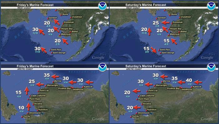
Marine forecast for the West Coast and Arctic Coast
Remote Sensing Images
Observations and Comments
Observations of Sea Ice Development
Observations from Wales
12 April 2017 – Robert Tokeinna, Jr.
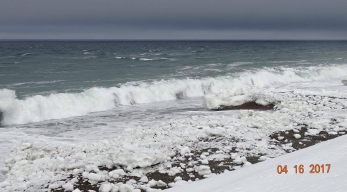
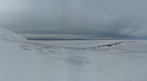
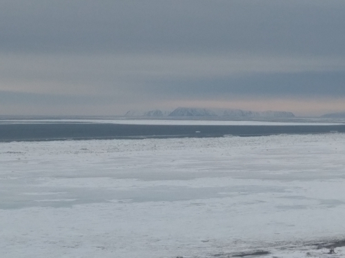
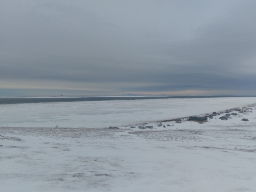
This past week in Wales, we have switched between mostly north cold winds and warm south winds beginning with northerly cool winds and switching to warm southerly winds later in the week. Confirmed sighting of birds and whaling crew members sighted Bowhead whale and marine ducks and seals. The local whaling crews were out cutting trail to the edge hoping to go out once launch site is ready for Bowhead whaling and sea mammal hunts. Today has warmed up to about balmy 25 degree with windy winds. Water pooling around back village and nearby airport. Little dribblers from Diomede came in with helicopter. As you can see in the photo you can see slot of open water with cakes of ice and pressure ridges along the edge from last week's southerly push of ice and form of young ice during north winds but since then I've have been moving back and forth but prominently open most recently. There are traces of water on the low spots of the ground and exposed ice.
Observations from Shishmaref
13 April 2017 – Curtis Nayokpuk
SE winds and warm temps to 40 above during the day. Forecast is for continued off shore winds so we will be looking to "Gina" and other sites for current sea ice movement. Lost a couple inches snow cover and hills showing tundra exposed from recent heat wave. More (new) Polar Bear tracks reported along coast toward Wales so they are moving North with spring weather conditions. No reports of access to ice edge with jagged piled ice limiting travel out to leads West but some hunters plan trips this weekend East "up coast" to do some "crabbing" and scout the leads close to shore.
Observations from Savoonga
14 April 2017 – Aqef Waghiyi
No more ice, just open water now out 20+ miles north of Savoonga. Not much shorefast ice left and it is real thin. Shorefast ice in some parts goes out maybe about a mile, some areas less. Some boats got in last night from hunting walrus, not sure how far out they went. Some got walrus though.
Observations from Nome
15 April 2017 – Boogles Johnson
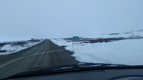
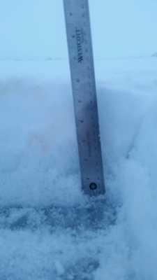
The snow is melting fast and there's tundra sprouting out of the snow all over between Nome & Cape Nome causing intense fog in the evening.


Observations from Gambell
16 April 2017 – Clarence Irrigoo, Jr.
