Assessment of Current Ice Conditions Relevant to Distribution and Access of Walrus
Click the name of each community below to view more frequently updated and detailed information from the National Weather Service.
Synopsis The storm track remains in the eastern Bering Sea through the middle of next week when it shifts to the central Bering Sea, swinging a front over the area.
Near St. Lawrence Island
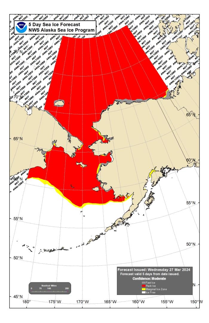
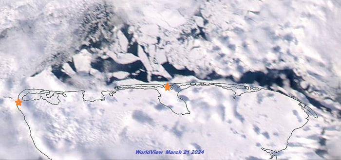
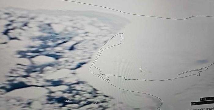
On Thursday, March 28th, a polynya extended off the west side of the island south of Gambell 5 to 10 nm. Beyond the polynya from the northwest of Gambell to the southeast of Gambell there is close to very close pack ice with medium to vast floes. There is a small polynya along the south side of this island between Powooiliak Camp and Siknik Training Camp. Otherwise, ice along the north and east sides of the island is close to very close pack ice consisting of small to big floes. Along the south side of the island is predominately young pack ice with small to big floes.
Nome
This area has not yet started for the 2024 SIWO season.
Nome port entrance webcam (via AOOS webpage): https://bering-sea.portal.aoos.org/?ls=79875242-e362-65cb-914e-fed20ff9…
Brevig Mission/Port Clarence Area
This area has not yet started for the 2024 SIWO season.
Wales to Shishmaref
This area has not yet started for the 2024 SIWO season.
Diomede
This area has not yet started for the 2024 SIWO season.
Forecast Discussion
Ice Forecast
Northerly winds will return over the weekend along with a much colder airmass. Pack ice will compact against the northern coastline. Expect a polynya to open along the south side of the island and freeze quickly. By the middle of next week, a front swinging into the Bering Sea might change the pattern briefly to southerly winds and a reversal of these conditions.
Wind Synopsis
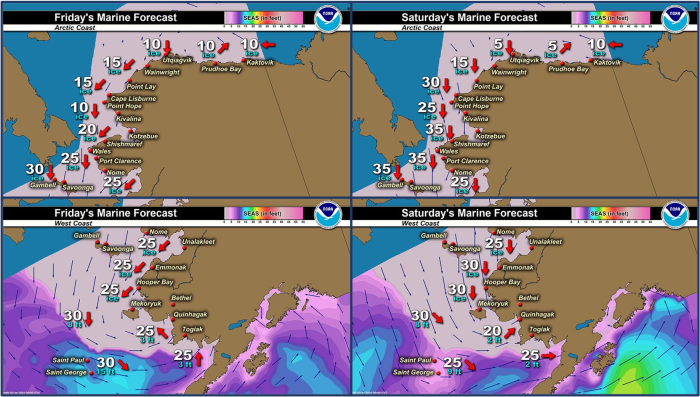
At Gambell today (Thursday, 28 March), winds are southwest 10 to 18 mph (5 to 15 kts) then becoming northeasterly and increasing to 20 to 35 mph with gusts to 50 mph (18 to 30 kts with gusts to 43 kts) Friday and into the weekend. Winds will diminish some Sunday night into Monday, becoming light and variable. A front will increase the winds again on Tuesday and Wednesday and become easterly 15 to 30 mph with gusts to 40 mph (13 to 26 kts with gusts to 35 kts) with snow and blowing snow.
Temperature Trend
Temperatures at Gambell will generally fall through the weekend. Highs in the low 20s on Friday will fall to near 7 F on Sunday and Monday, with lows falling to 5 to 15 F below zero during that same period. From Tuesday onward, highs will be in the upper teens to near 20, with lows around 10 F above.
Daily Weather, Wind, and Temperature Updates
The National Weather Service provides twice-daily, text only updates on the weather, wind, and temperature conditions in specific geographical zones. An interactive weather map for access to other Alaskan zones can be found here: http://weather.gov/anchorage/ice
Higher resolution satellite images and wind maps (wind updated daily) can be viewed here: http://www.weather.gov/afg/SIWO_overview
The Alaska Ocean Observing System shares a variety of weather and sea ice related resources in their Bering Sea Portal at https://bering-sea.portal.aoos.org/.
Marine forecast for the West Coast and Arctic Coast
Remote Sensing Images
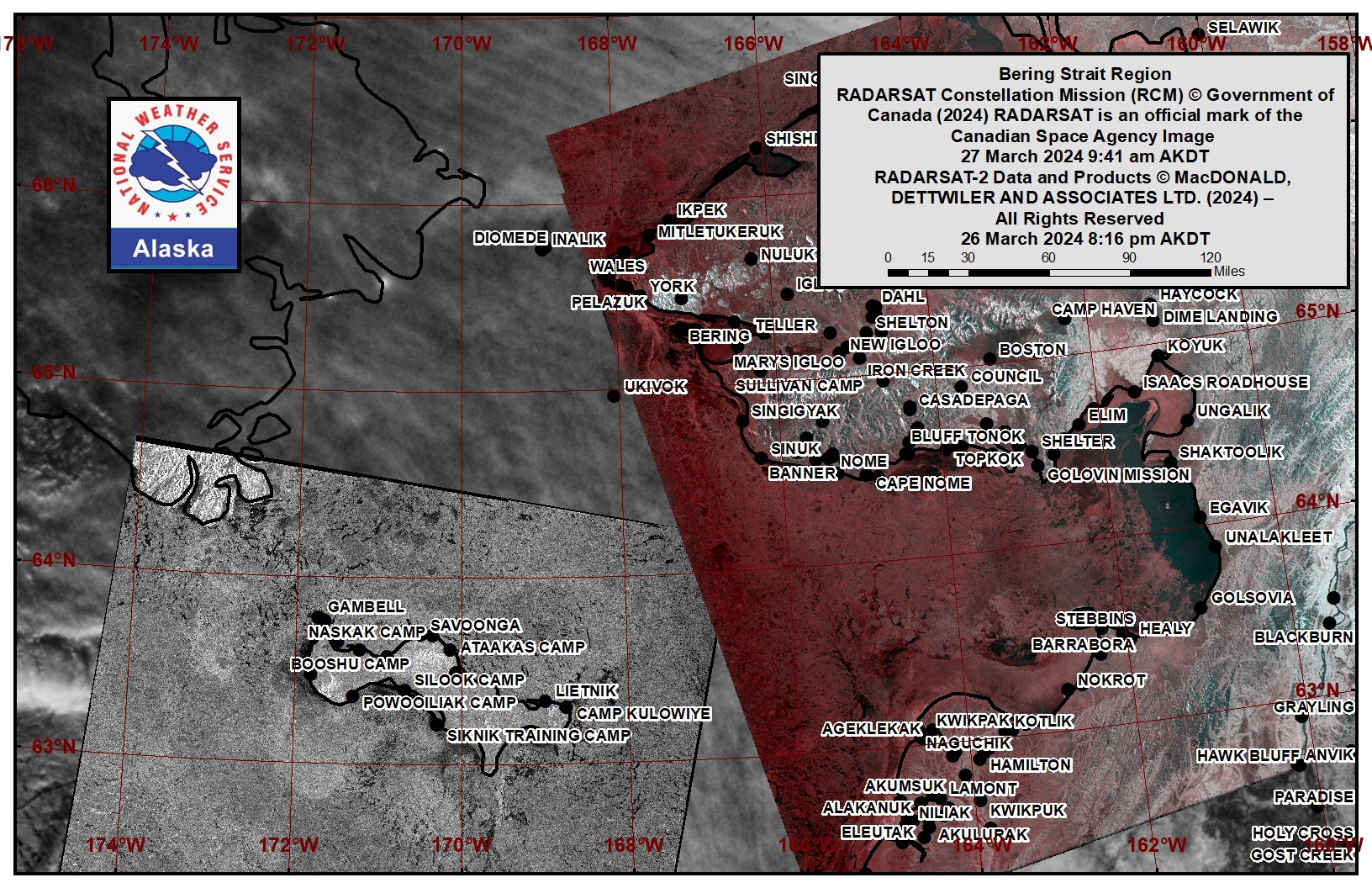
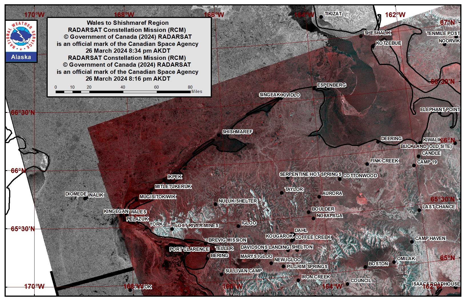
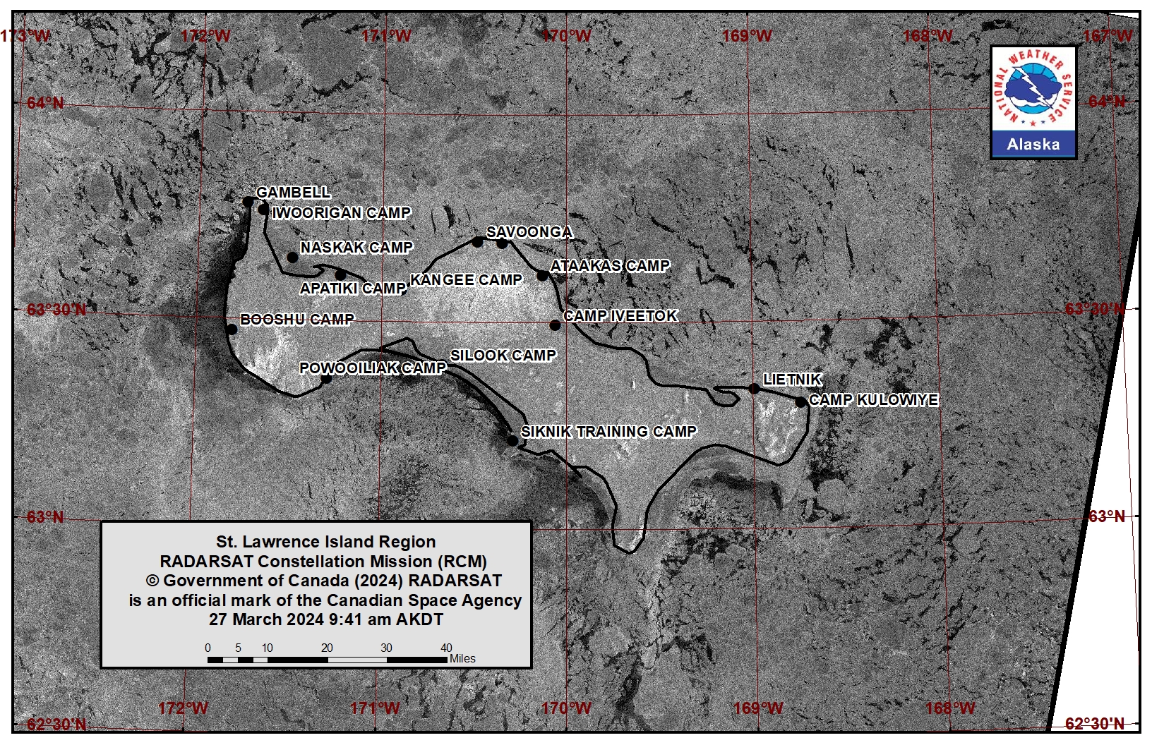
Observations and Comments
Observations of Sea Ice Development
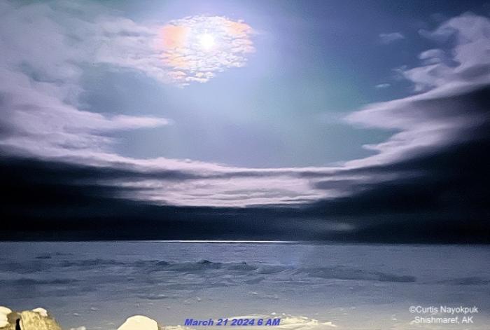
Observations from Shishmaref
Thursday, 28 March 2024 – Curtis Nayokpuk
Storm winds from South broke up sea ice. Winds to 30 mph from North returning by weekend. Will be thin ice out there this spring hunting season.
Observations from Savoonga
Thursday, 28 March 2024 – Aqef Waghiyi
There’s open water but haven’t heard anything about people going boating. 36, calm, no wind, dew point 44.2, pressure 1004.7.
Observations from Port Clarence, Brevig Mission, and Cape Douglas
Thursday, 28 March 2024 – Marcus Barr
Not able to head out today, but shorefast ice had broken off near Port Clarence. Last week we had warm temps and strong southernly winds. Looks like the ice edge is about 1/4 mile off the beach north of Port Clarence. Will see next week after wind gusts to 60 mph this weekend.
Observations from Gambell
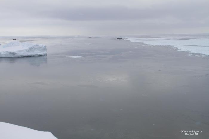
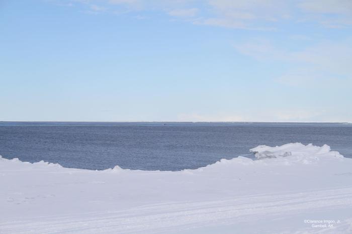
Friday, 29 March 2024 – Clarence Irrigoo, Jr.
Will be doing whaling first at this time. Today is blizzard out. Boats that went out have some walrus and seals.
Observations from Wales
Friday, 29 March 2024 – Robert Tokeinna, Jr.
For this week it's been a breezy, blizzardy week for Wales. You can see the pressure ridges close to shore. The Shorefast Ice did not freeze until well after the New Years, we had waves for Christmas which has been happening more than often over the years. Lots of breezy northeast and southeast winds with it blowing 20 to 30 with intermittent breaks when switching directions, temperatures have been ranging from single digits below zero and high as 30 degrees this week and seems to be the trends for the next few weeks. No pictures as weather has been whiteout conditions or blowing snow lately. More to come this coming week.
Observations from Diomede
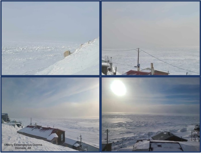
Sunday, 31 March 2024 – Marty Eeleengayouq Ozenna
We’re about 35–40 knots north wind, open water to the south about a mile out to the north we're about 4–5 miles open off and on close, and our weather died down finally, we're gusting past couple days.
Additional Comments Provided by Local Experts and Other Contributors
Shared by the Alaska Ocean Observing System (AOOS) for 27 March–4 April 2024
Visit the SIWO Facebook page @seaiceforwalrus to view this animation showing the predicted movement of ice predicted by the HYbrid Coordinate Ocean Model (HYCOM). Snapshots from the forecast show ice coverage from 0% (black) to 100% (white) and arrows show the relative speed and direction of the ice. A light boundary is drawn at 15% predicted ice cover to highlight the ice edge, but ice may be predicted to extend beyond it. Some bays, lagoons, and areas very close to shore are not covered by the model. (Image produced by the Alaska Ocean Observing System / Axiom Data Science).

