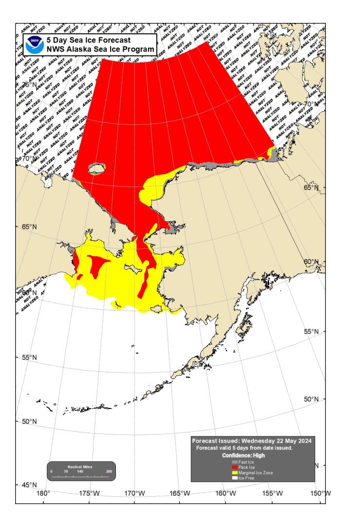
Assessment of Current Ice Conditions Relevant to Distribution and Access of Walrus
Click the name of each community below to view more frequently updated and detailed information from the National Weather Service.
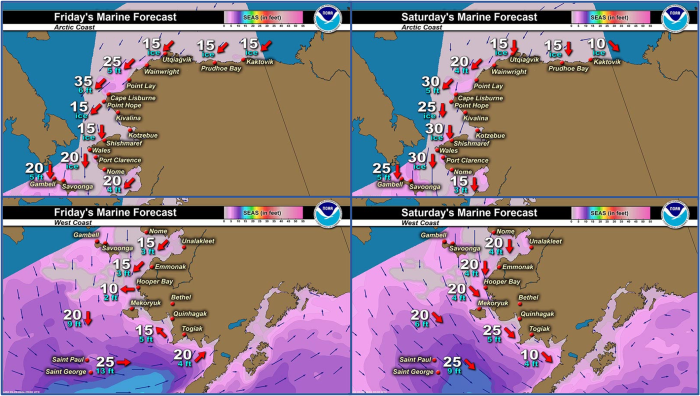
Synopsis: A low pressure system will move from the central Bering Sea toward Nunivak Island on Friday, then into the Gulf of Alaska on Saturday. Generally northerly low will remain until high pressure settles in by the middle of next week.
Near St. Lawrence Island
Open water extends from the south of the island up to 90 miles (144 km) but the closest ice is 22 miles (35 km) south of Kialegak Point which is open to close pack ice made up of ice cakes to small floes. There is consolidated to very close pack ice between Iwoorigan Camp to Kangee Camp, extending 4 miles (6.5 km) off the coast. Around Savoonga is open pack ice that is melting brash ice to small floes up to 6 miles (9.6 km) off the coast. Some shorefast ice remains intact between Camp Iveetok through Lietnik up to 3 miles (4.8 km) off the coast. East of the island is open pack ice with brash to small floes. West of the island is open water with several small areas of very open pack ice 6 to 20 miles (9.6 to 32 km) west of Gambell.
Nome
Shorefast ice extends up to 3 miles (5 km) offshore along the Nome coastline. Beyond the shorefast ice is melting areas of both open and close pack ice consisting of small to medium floes with the occasional big to vast floes. Pack ice extends around 20 miles (32 km) south of Nome with open water beyond to the southeast. Close to very close pack ice with medium to vast floes is 22 miles (35 km) and beyond to the southwest.
Nome port entrance webcam (via AOOS webpage): https://bering-sea.portal.aoos.org/?ls=79875242-e362-65cb-914e-fed20ff9…
Brevig Mission/Port Clarence Area
Shorefast ice remains within the area from Port Clarence to Brevig Mission. To the west of Port Clarence, the polynya extends 25 miles (40 km) to the west and is open water. Beyond the polynya is close to very close pack ice consisting of all sizes from small/medium up to vast/giant floes.
Wales to Shishmaref
Shorefast ice extends up to 4 miles (6 km) offshore except up to 14 miles (23 km) offshore near Wales. A polynya then extends between 10 and 50 miles (16 to 80 km) to the north/northwest from the coast and is open water with brash ice. 8 miles (12 km) to the northeast of Shishmaref is an area of open pack ice comprised of small to big floes.
Diomede
Some compact ice remains between the islands. There is a small polynya north of the island up to 6 miles (9.6 km). Otherwise, consolidated ice consisting of mainly vast to giant floes surrounds the island.
Forecast Discussion
Ice Forecast
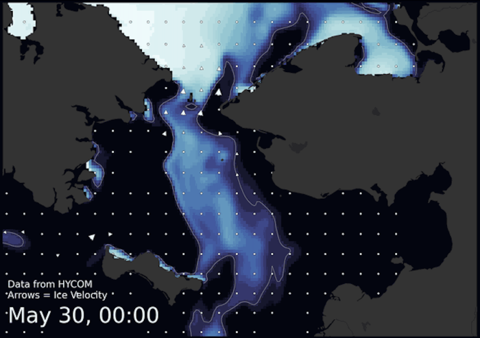
Generally northerly winds will drift the pack southward on the order of 5–10 nm/day through the weekend. Wind drift and tides/currents will have equal weight in moving ice for the next week. As we get into the middle of next week, winds lightening will give tides and currents the upper hand. Expect continued slow melt of the ice and thinning of pack ice.
Wind Synopsis
North 15 to 20 kt (17 to 22 mph) on Friday, except north 10–15 kt (11 to 16 mph) at Nome.
Saturday winds will increase to north 20 to 30 kt (22 to 33 mph), except north 15 kt (17 mph at Nome).
Sunday winds will decrease to north 15 to 25 kt (17 to 27 mph).
Monday through Wednesday north 10–15 kt (11 to 17 mph).
Thursday and Friday northeast 15 kt (17 mph).
Temperature Trend
The upper 20s to mid 30s Friday and Saturday, except in the 30s and lower 40s at Nome. Sunday temps falling into the 20s and lower 30s, except upper 20s to near 40 at Nome. Little change in temps Monday and Tuesday. Temps warming Wednesday into upper 20s to mid 30s, except lower 30s to lower 40s at Nome.
Daily Weather, Wind, and Temperature Updates
The National Weather Service provides twice-daily, text only updates on the weather, wind, and temperature conditions in specific geographical zones. An interactive weather map for access to other Alaskan zones can be found here: http://weather.gov/anchorage/ice
Higher resolution satellite images and wind maps (wind updated daily) can be viewed here: http://www.weather.gov/afg/SIWO_overview
The Alaska Ocean Observing System shares a variety of weather and sea ice related resources in their Bering Sea Portal at https://bering-sea.portal.aoos.org/.
Marine forecast for the West Coast and Arctic Coast
Remote Sensing Images
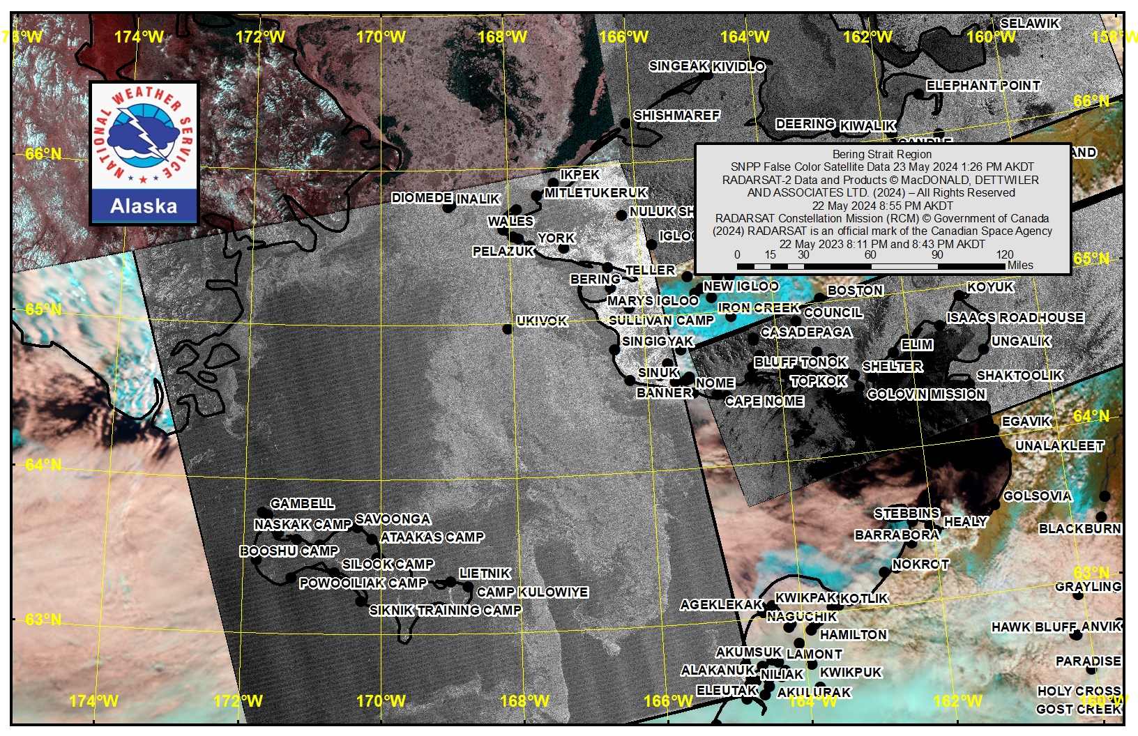
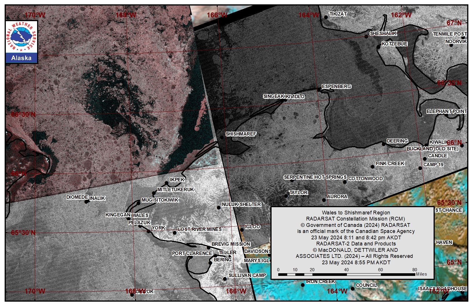
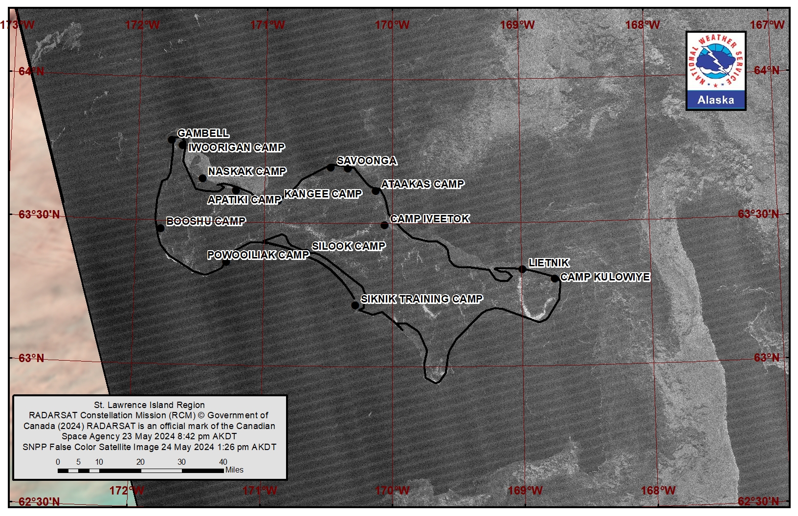
Observations and Comments
Observations of Sea Ice Development
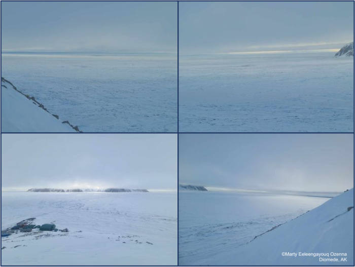
Observations from Diomede
Monday, 20 May 2024 – Marty Eeleengayouq Ozenna
We've been opening closing from the north and south and 15-20 knots north wind today.
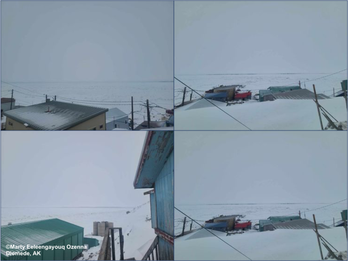
Friday, 24 May 2024 – Marty Eeleengayouq Ozenna
We have 15–25 knots north wind took a climb for a above view for everyone an the north side an south side been opening an closing.
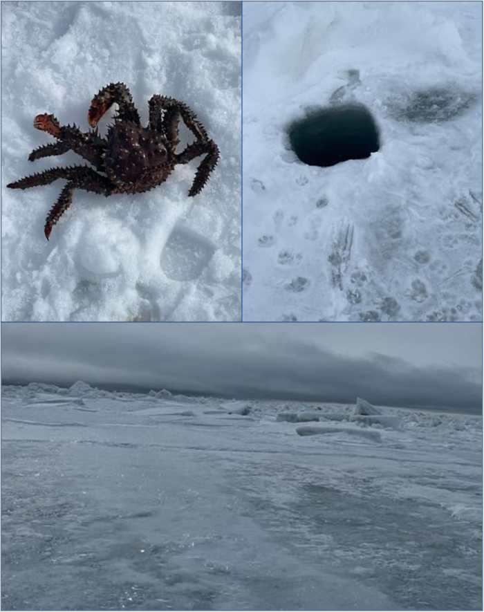
- Monday, 20 May 2024 – Odge Ahkinga*
Sea ice current condition. Slowly melting. Hand line crabbing slowly picking up and still no ocean current. Seals using our crabbing hole to sun bathe. I experienced this type of sea ice before. Ice didn’t break off but rotted away kept us from hunting. May be a late subsistence hunt. Very unusual weak sea currents slow crabbing.
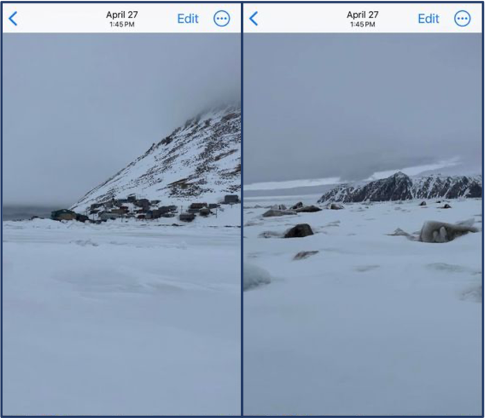

Observations from Savoonga
Monday, 20 May 2024 – John Kulowiyi
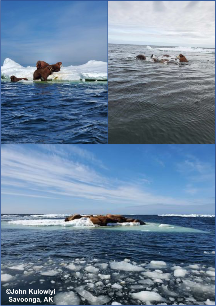
Friday, 24 May 2024 – John Kulowiyi
Video shared by John Kulowiyi, taken near Savoonga.
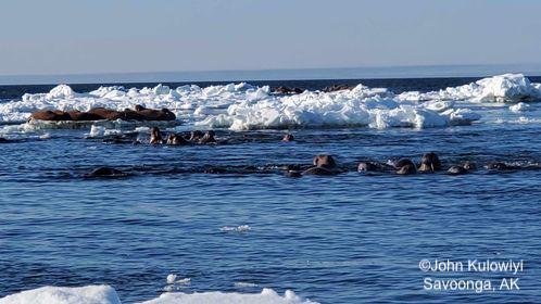
Observations from Savoonga
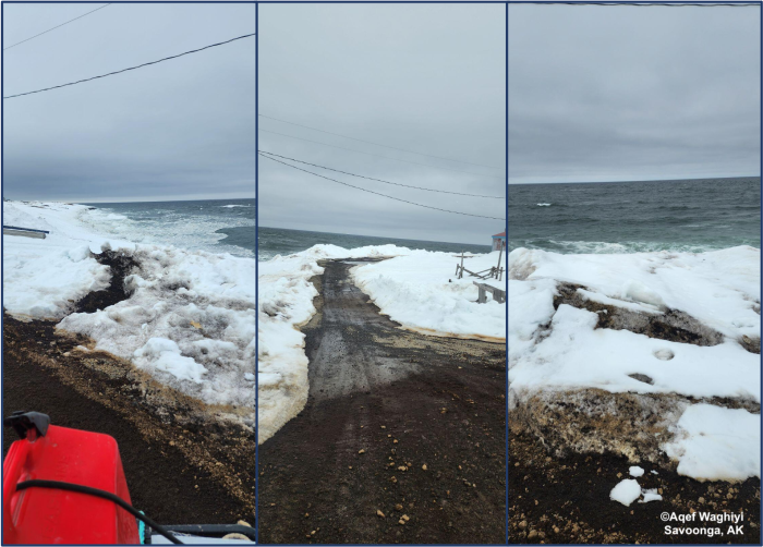
Saturday, 25 May 2024 – Aqef Waghiyi
Wind speed 28 NE 63deg, pressure 1020.6, dew point 27.8, humidity 86.9, temperature 30.7 deg. Last time people went boating was two days ago and they got walrus, 1 or 2 boats got female with calf and some boats got bearded seal with pup.
Observations from Port Clarence, Brevig Mission, and Cape Douglas
Friday, 24 May 2024 – Marcus Barr
Nobody got walrus since a week ago. Ice has been blocked to go out in the ocean. As for Shorefast ice near Port Clarence, it's has been breaking off slowly.
Observations from Shishmaref
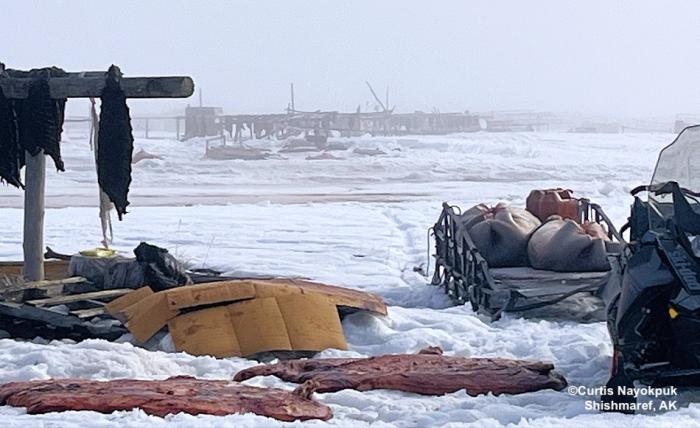
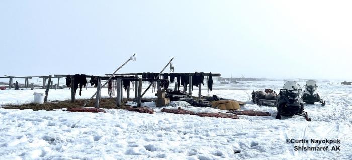
Friday, 24 May 2024 – Curtis Nayokpuk
Hunters still out taking advantage of light winds with daily fog. Subsistence racks filling up with Bearded Seals (Oogruk).
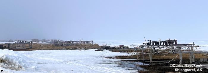
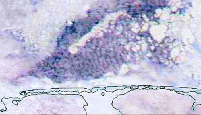
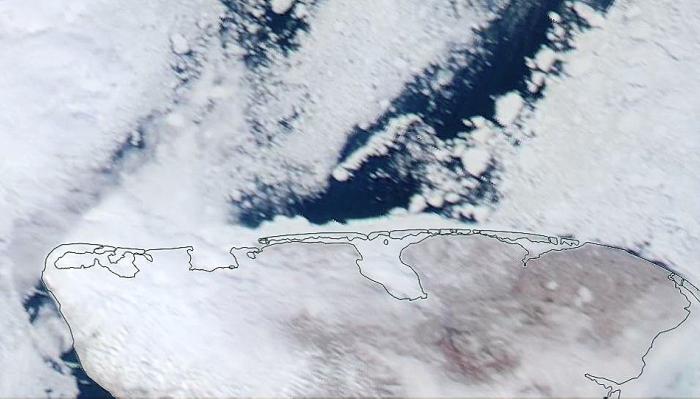
Saturday, 25 May 2024 – Curtis Nayokpuk
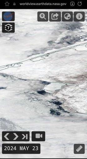
Latest Worldview sat. pass. Fog cleared out, north winds to 15–20 so hunters should be back on shorefast ice. Ducks and Geese for weekend break, Snow Geese heading west and Black Brant flying east.
Observations from Nome
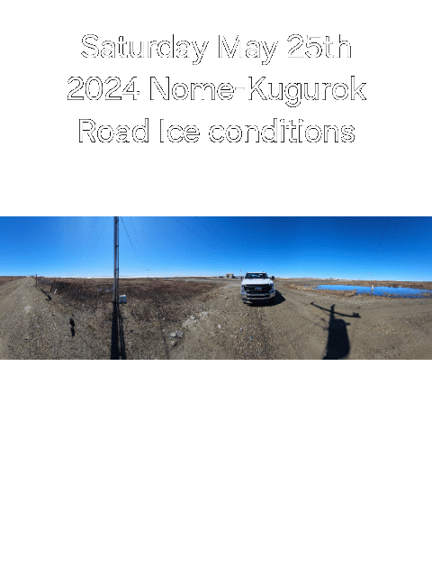
Saturday, 25 May 2024 – Boogles Johnson
Thank you to Boogles Johnson for sharing this slideshow of sea ice and weather conditions in Nome.
Additional Comments Provided by Local Experts and Other Contributors
Shared by the Alaska Ocean Observing System (AOOS) for 22–30 May 2024
Visit the SIWO Facebook page @seaiceforwalrus to view this animation showing the predicted movement of ice predicted by the HYbrid Coordinate Ocean Model (HYCOM). Snapshots from the forecast show ice coverage from 0% (black) to 100% (white) and arrows show the relative speed and direction of the ice. A light boundary is drawn at 15% predicted ice cover to highlight the ice edge, but ice may be predicted to extend beyond it. Some bays, lagoons, and areas very close to shore are not covered by the model. (Image produced by the Alaska Ocean Observing System / Axiom Data Science).

