Assessment of Current Ice Conditions Relevant to Distribution and Access of Walrus
Click the name of each community below to view more frequently updated and detailed information from the National Weather Service.
Synopsis: High pressure develops over Norton Sound Friday (June 14th), moving west to be centered over St. Lawrence Island Saturday (June 15th) and then slowly moves west into the western Bering Sea Sunday (June 16th) into Monday (June 17th). High pressure persists over the western Bering Sea through Thursday (June 20th).
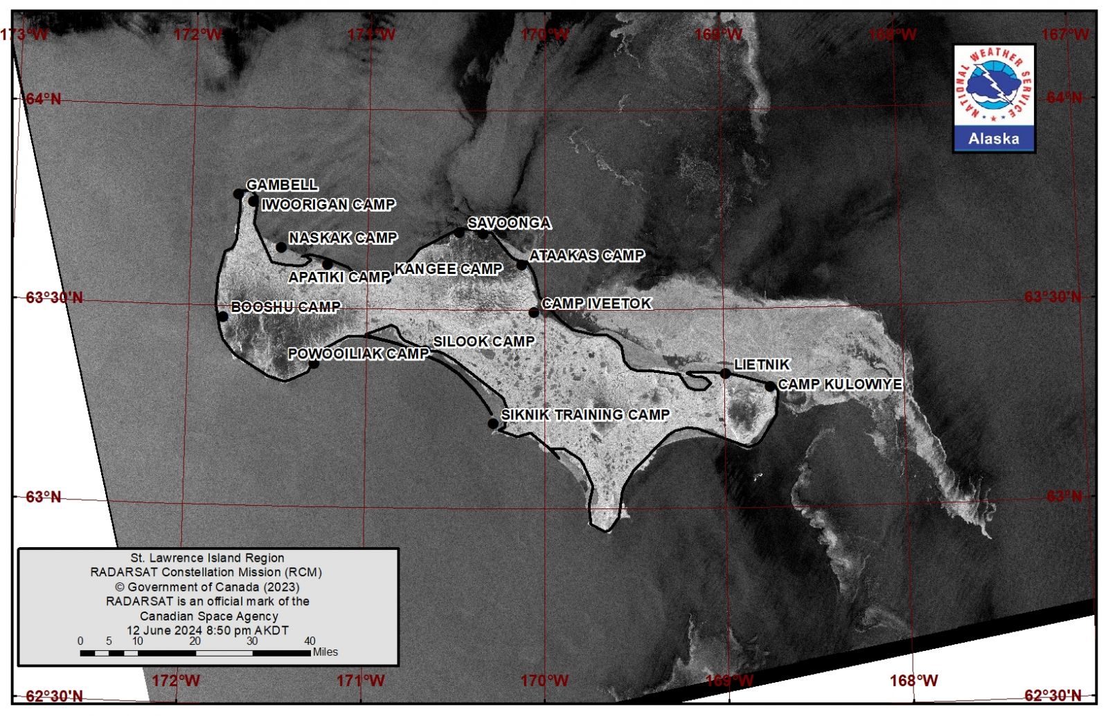
Near St. Lawrence Island
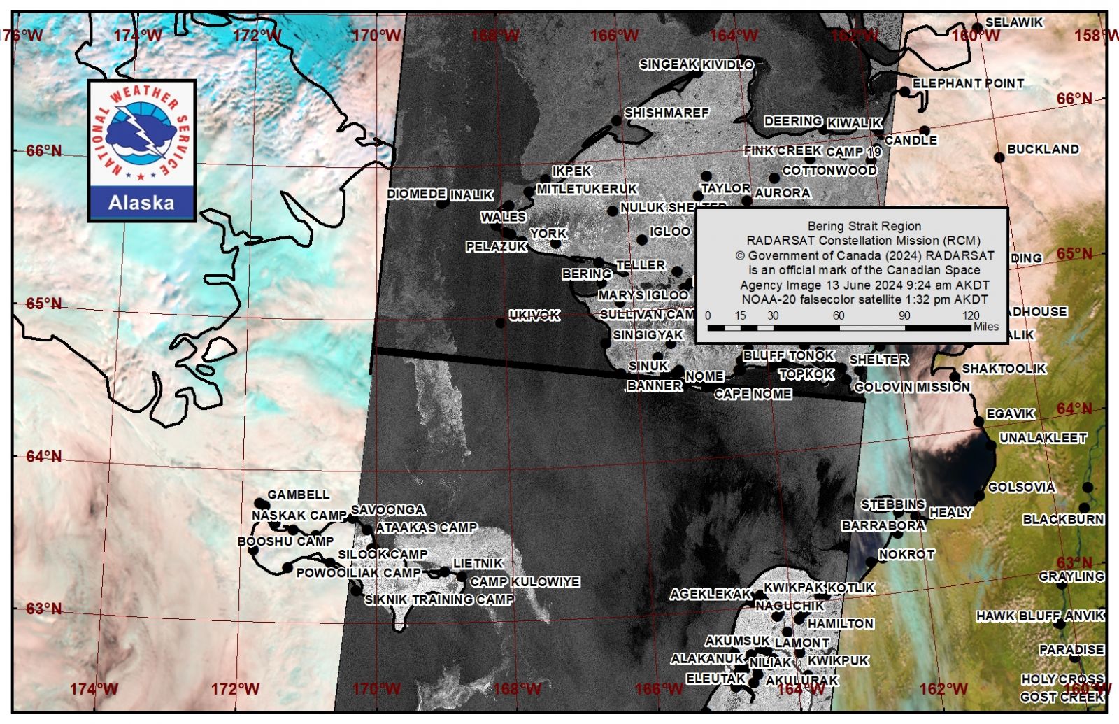
Ice-free conditions stretch from just west of Savoonga around the west and southern coastlines of the island. Between Savoonga and Camp Kulowiye is the only remaining ice. Open pack ice with brash ice to ice cakes is from Savoonga off the coast up to 6 nm (9.6 km) through Ataakas Camp. The majority of the ice is between Camp Iveetok and Camp Kulowiye. There remains decaying shorefast ice that transitions to close pack ice up to 16 miles (26 km) to the north, with small to big floes and open water beyond. The close pack ice transitions to very open to open pack ice southeast of the island with brash ice and ice cakes.
Nome
Norton Sound is ice free for the season.
Nome port entrance webcam (via AOOS webpage): https://bering-sea.portal.aoos.org/?ls=79875242-e362-65cb-914e-fed20ff9…
Brevig Mission/Port Clarence Area
Shorefast ice broke off in the last week and has drifted northward toward Brevig mission. It is still a consolidated giant floe, but will likely begin to break apart in to smaller floes in the following week. Otherwise, Port Clarence area is open water or very open pack ice with small to medium floes.
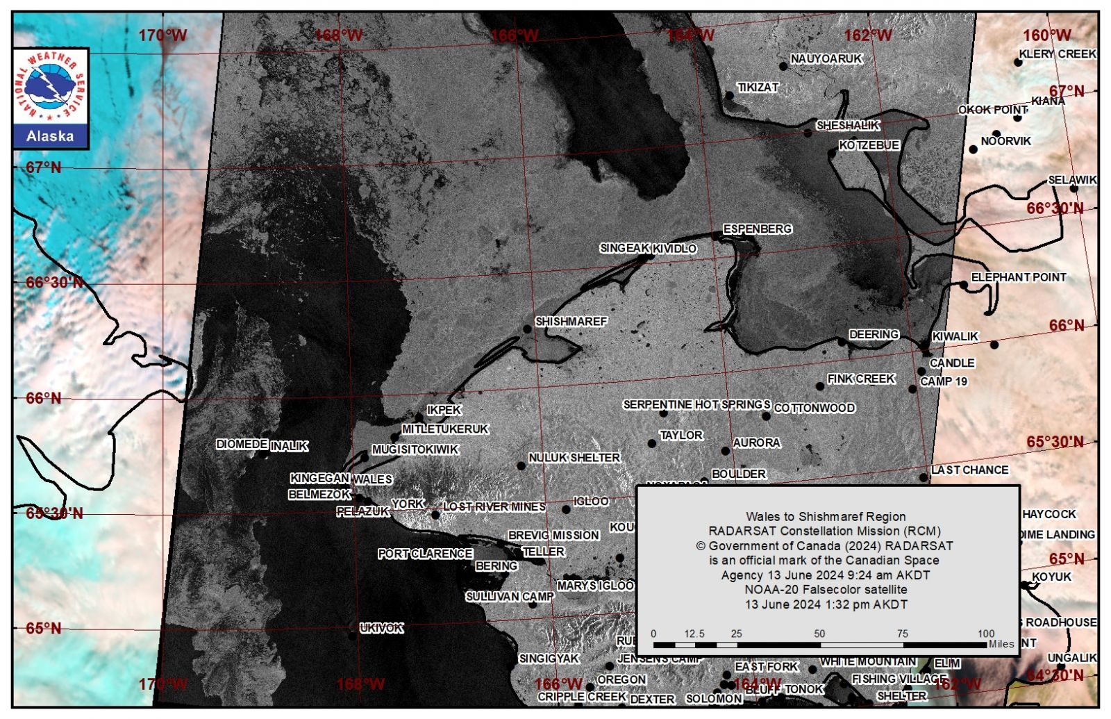
Wales to Shishmaref
Shorefast ice extends up to 3 miles (4.8 km) offshore except up to 14 miles (23 km) offshore near Wales. It is beginning to erode from the edge near Wales as well as near the barrier islands. Near Wales, open water lies beyond the shorefast ice with brash ice to small floes. From Shishmaref, beyond the shorefast ice is very close to consolidated ice with medium to vast floes and extends up to 30 miles (48 km) offshore.
Diomede
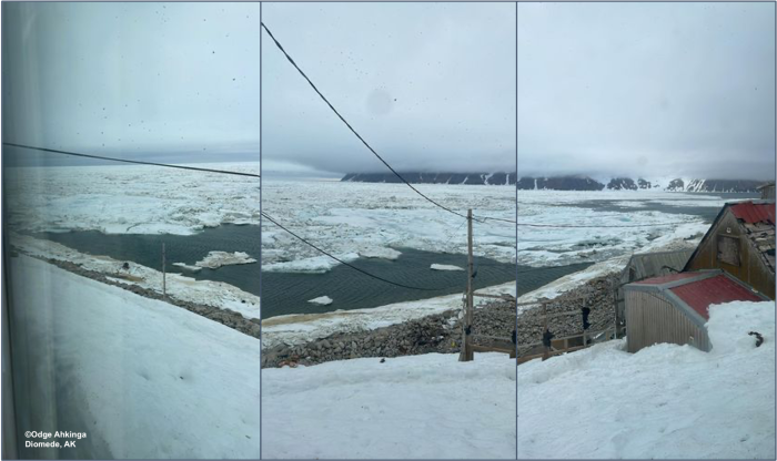
Open water surrounds Diomede with only brash ice between Diomede and Wales. There is very open pack ice to the northwest of Diomede with brash ice and ice cakes. To the west of Diomede is an area of open to close pack ice with brash to small floes extending to near the Russian coast.
Forecast Discussion
Ice Forecast
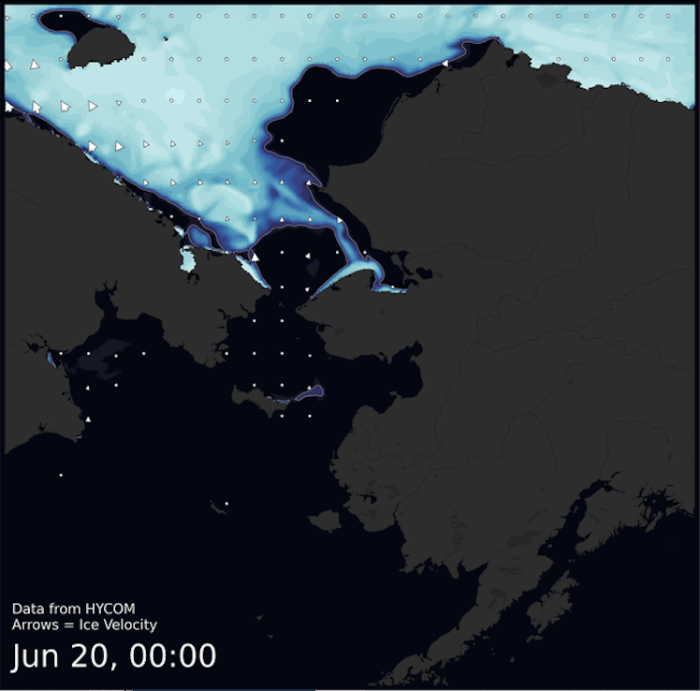
Ice around St. Lawrence Island will continue to degrade quickly, especially the brash ice southeast of the island. The remaining pack ice will drift to the north of the island around 10 nm/day over the next few days, then linger through mid-week while melting. The Diomede area will remain within the stream of open pack ice coming up from the south. The Wales to Shishmaref region will likely see the shorefast ice begin to degrade quickly over the next week, although the pack ice will remain, but possibly open up to close pack ice. Ice around Port Clarence will likely break down and melt quickly over the next week.
Wind Synopsis
Near St. Lawrence Island, southwest winds of 10 to 15 knots (12 to 17 mph) are expected Friday (June 14th) diminishing Saturday (June 15th) to 5 to 10 knots (6 to 12 mph) and persisting through Sunday (June 16th). Sunday night west southwest winds increase to 10 to 15 knots (12 to 17 mph) and persist through Monday (June 17th) diminishing Monday night to 5 to 10 mph (6 to 12 mph) and then shifting to the northeast Tuesday (June 18th) at 5 to 10 knots (6 to 12 mph). On Thursday (June 20th), winds become more northwesterly and increase to 10 to 15 knots (12 to 17 mph).
Near Wales and Diomede, south winds of 15 to 20 knots (17 to 23 mph) are expected Friday (June 14th) through Sunday (June 16th) diminishing to 10 to 15 knots (12 to 17 mph) Sunday night. Winds become light and variable Monday night and then shift to the north at 5 to 10 knots (6 to 12 mph) Tuesday (June 18th) and persist.
Near Shishmaref, south winds of 10 to 15 knots (12 to 17 mph) are expected Friday (June 14th) becoming southwesterly Saturday (June 15th) afternoon. Winds diminish to 5 to 10 knots (6 to 12 mph) by Monday (June 17th) and then shift to the northwest Monday night. Northwest winds of 5 to 10 knots (6 to 12 mph) persist through Thursday (June 20th).
Near Port Clarence, south winds of 10 to 15 knots (12 to 17 mph) are expected Friday (June 14th) becoming southwesterly Saturday (June 15th) and diminishing to 5 to 10 knots (6 to 12 mph). Winds become light and variable late Sunday (June 16th) before shifting to the north northwest 5 to 10 knots (6 to 12 mph) Tuesday (June 18th) and persisting through Thursday (June 20th).
Temperature Trend
Near St Lawrence Island, highs in the lower 40s Friday (June 14th) through Tuesday (June 18th), cooling into the mid to upper 30s Wednesday (June 19th) and Thursday (June 20th). Lows in the mid-30s.
Near Wales and Diomede, highs in the mid to upper 30s. Lows in the lower 30s.
Near Shishmaref, highs near 40 Friday (June 14th) through Sunday (June 16th), and then upper 30s Monday (June 17th) through Thursday (June 20th). Lows in the upper 20s to lower 30s.
Near Port Clarence, mid to upper 40s Friday (June 14th) and Saturday (June 15th), warming into the low to mid 50s Sunday (June 16th) through Tuesday (June 18th), cooling into the mid to upper 40s Wednesday (June 19th) and Thursday (June 20th). Lows in the mid to upper 30s.
Near Nome, highs near 50 Friday (June 14th) warm into the mid-50s Saturday (June 15th), and into the lower 60s Sunday (June 16th) through Tuesday (June 18th), cooling into the mid to upper 50s Wednesday (June 19th) and Thursday (June 20th). Lows in the lower to mid 40s.
Daily Weather, Wind, and Temperature Updates
The National Weather Service provides twice-daily, text only updates on the weather, wind, and temperature conditions in specific geographical zones. An interactive weather map for access to other Alaskan zones can be found here: http://weather.gov/anchorage/ice
Higher resolution satellite images and wind maps (wind updated daily) can be viewed here: http://www.weather.gov/afg/SIWO_overview
The Alaska Ocean Observing System shares a variety of weather and sea ice related resources in their Bering Sea Portal at https://bering-sea.portal.aoos.org/.
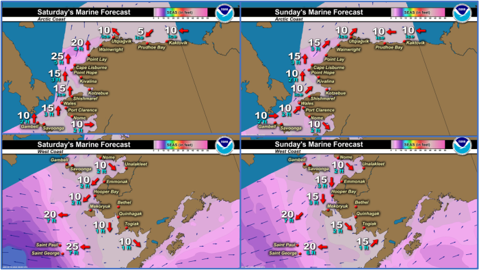
Marine forecast for the West Coast and Arctic Coast
Remote Sensing Images
Observations and Comments
Observations of Sea Ice Development
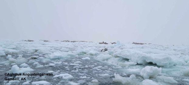
Observations from Gambell
Wednesday, 12 June 2024 – Aghilluk Angqatenganwan
Still a little bit of ice around, a lot of bulls on the last of the pods of ice. Still a little bit of ice around Gambell, last of the Anadyr ice is passing.
Observations from Diomede
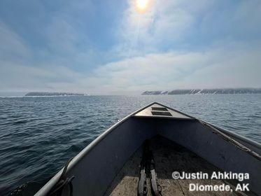
Wednesday, 12 June 2024 – Odge Ahkinga
Diomede was finally able to go hunting. Successfully caught two Bearded seal and two ring seals. I left my cell phone behind and got pictures from my nephew. We since a few walruses but the sea ice was packed and the conditions of the ice wasn’t too safe to harvest, hopefully the next hunting trip will be better.
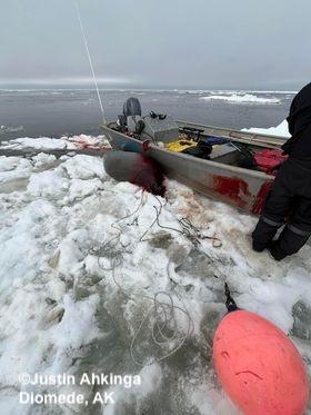
Friday, 14 June 2024 – Odge Ahkinga
Current sea ice conditions in Diomede came in heavy from the south with winds gusting 35.
Observations from Port Clarence, Brevig Mission, and Cape Douglas
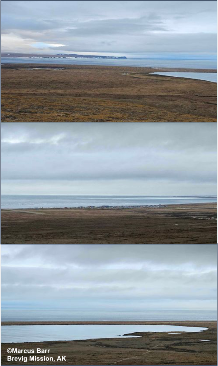
Thursday, 13 June 2024 – Marcus Barr
Last bit of ice in our bay came up to the shore after north winds blew it down. Most hunters are done boating. Past 2 weeks was egg gathering.
Observations from Savoonga
Friday, 14 June 2024 – Aqef Waghiyi
Pretty calm today. Light breeze from the south. Barometer at 1024.5, dew point 52.8, heat index 42.4, getting warm. Humidity 62.5, not reading the wind, real light breeze from the south. No crosswind.
When they went out 3-4 days ago a few boats got bull walrus, some got female with calf. Between 15-25 miles N NE. Now everybody’s getting all their fishing gear ready (halibut). Snow is melting pretty fast in town, but we still got quite a bit of snow outside of town. Few days ago when it was north wind a few people seen walrus swimming by going east.
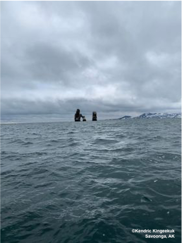
Saturday, 15 June 2024 – Kendric Kingeekuk
Walrus in the water.
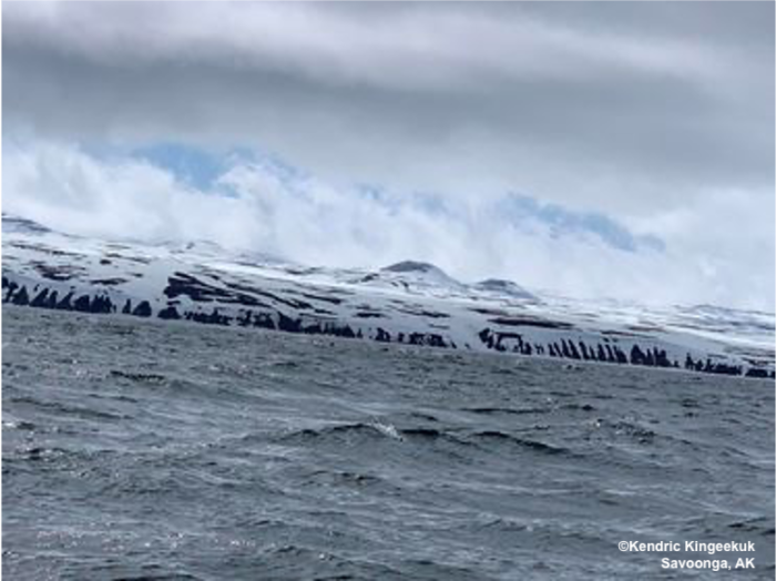
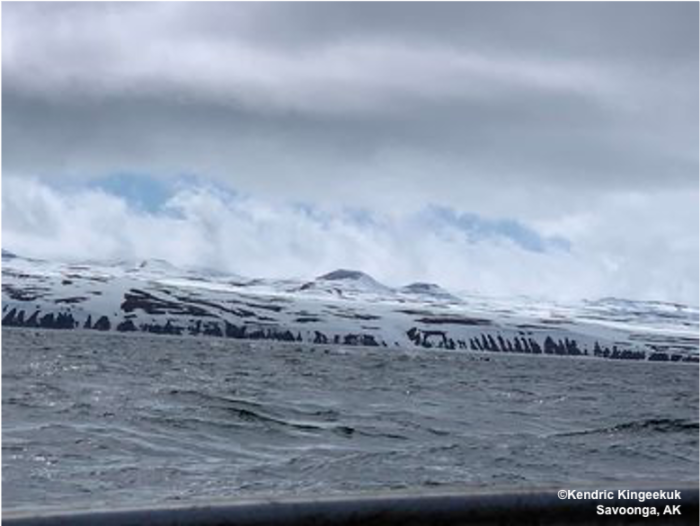
East side.
Observations from Nome
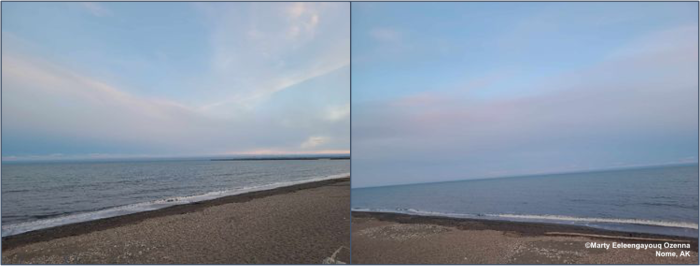
Saturday, 15 June 2024 – Marty Eeleengayouq Ozenna
The wind is southwest 10-15 knots temp 60 in the sun feels like 56 degrees sunny with a little breeze.
Additional Comments Provided by Local Experts and Other Contributors
Shared by the Alaska Ocean Observing System (AOOS) for 12–20 June 2024
Visit the SIWO Facebook page @seaiceforwalrus to view this animation showing the predicted movement of ice predicted by the HYbrid Coordinate Ocean Model (HYCOM). Snapshots from the forecast show ice coverage from 0% (black) to 100% (white) and arrows show the relative speed and direction of the ice. A light boundary is drawn at 15% predicted ice cover to highlight the ice edge, but ice may be predicted to extend beyond it. Some bays, lagoons, and areas very close to shore are not covered by the model. (Image produced by the Alaska Ocean Observing System / Axiom Data Science).


